Why this list was rewritten from scratch
Popular trail listings for Germany tend to repeat the same ten postcards: a lake under the Zugspitze, a castle, three gorges, a rock bridge and a mountain loop in the Black Forest. Every entry from that shortlist was checked against the people who actually look after the place. The result is shorter on adjectives and longer on facts, and it corrects a few things. One lake loop is a bit shorter than the listing says. Three entries are closed or partly closed today. One entry that listings still mark as closed has reopened.
All statuses below were checked on 16 October 2026. They were true on that day and can change quickly, because gorges, rock paths and bridges are the kind of terrain where storms and rockfall cause sudden closures. Treat the checks as a starting point and look at the operator's page on the morning you go.
Each entry uses the same set of facts: what it is, length and time, status, getting there, rules and costs, and who it suits.
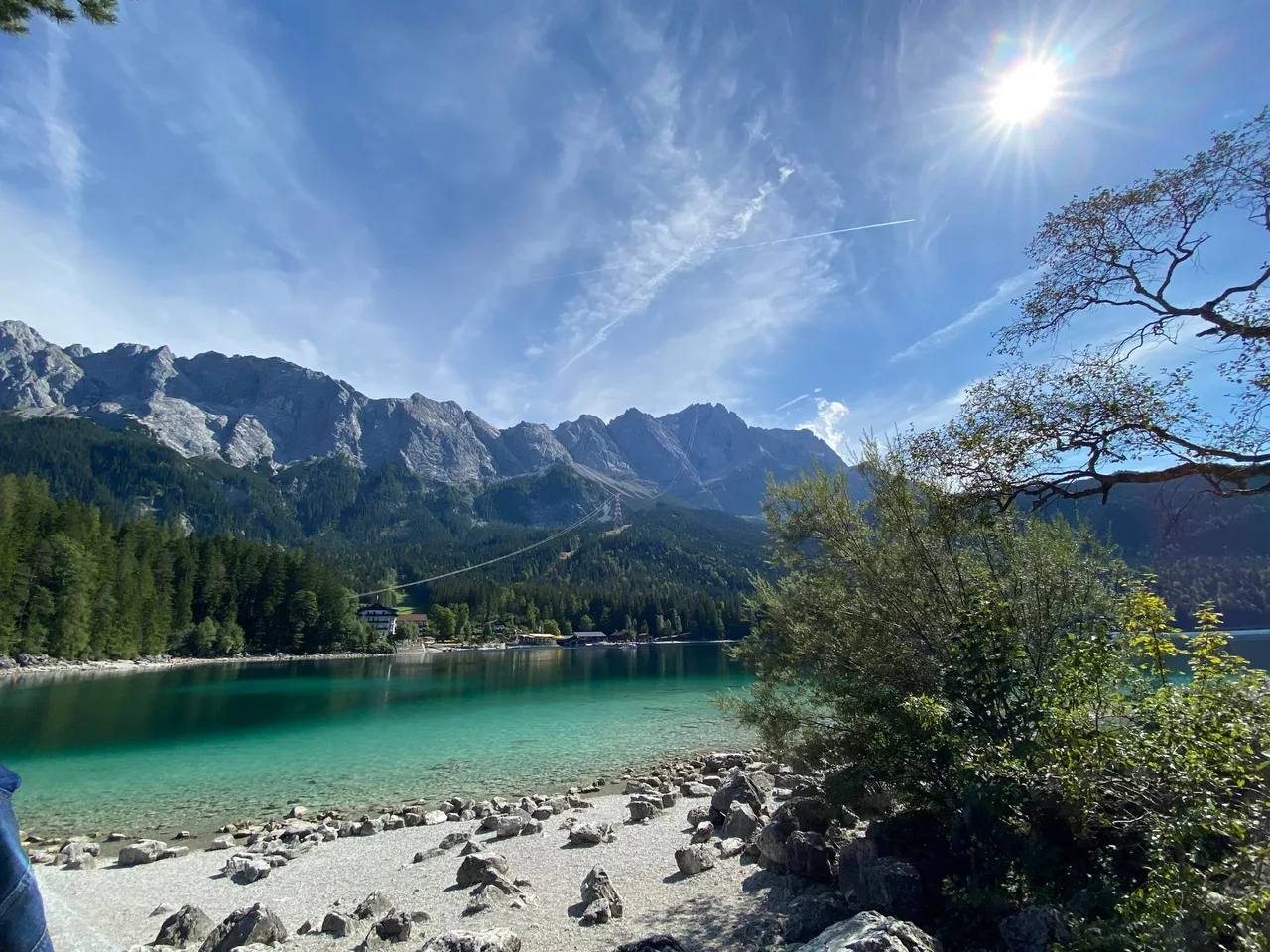
1. Eibsee loop near Grainau (Bavaria)
What it is. A flat, well-built path around a green-turquoise lake directly beneath the Zugspitze massif, Germany's highest mountain. The best views of the rock wall come from the north shore.
Length and time. The Grainau tourism office publishes 6.84 km, about 1 h 54 min, with 123 m of ascent and 114 m of descent between 973 and 1,018 m. That is shorter than the 7.2 km many listings quote, so do not plan a tight timetable around the higher figure. Difficulty is rated very easy.
Status. No closure notice for the path was found on 16 October 2026.
Getting there. The loop starts and ends at the Eibsee hotel. The tourism office recommends the Bavarian Zugspitze railway and the bus. With the Grainau guest card these are free. Car parking is paid, and on fine days the access road and car park are often closed because they are full.
Rules and costs. No entry fee for the path itself. Pack out your rubbish. There are swimming spots, boat rental and a few places to eat, so a full day is easy to fill.
Suits. Families, prams (the tourism office lists the path as pram-friendly), short days, anyone who wants a big mountain view without climbing.
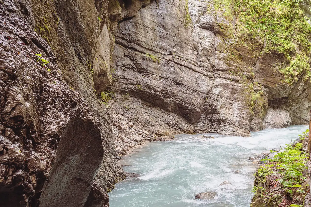
2. Partnach Gorge near Garmisch-Partenkirchen (Bavaria)
What it is. A narrow gorge cut by the Partnach river, 702 m long and in places more than 80 m deep. It has been a natural monument since 1912, and a rock gallery of 108 m was blasted in 1992 after a rockfall blocked the old path in 1991.
Length and time. Inside the gorge it is a walk of about 700 m each way, so most people see it as part of a longer outing. The nearest car park, at the Olympic ski stadium, is 2.2 km from the gorge entrance, about a 25-minute walk. A loop that returns via Graseck is described under entry 3.
Status. Open. Opening hours are 08:00 to 20:00 from June to September and 08:00 to 18:00 from October to May, with the last admission 30 minutes before closing. The operator warns that short closures for safety are sometimes unavoidable and that the gorge is locked outside opening hours. The operator's press notices say the path after the gorge towards Vordergraseck is closed for building work from 21 September to 20 November 2026; all other paths around the gorge are open.
Getting there. Regional trains run from Munich main station to Garmisch-Partenkirchen in about 1.5 hours. From the station, local bus line 1 or 2 towards "Skistadion" takes about 10 minutes. Parking at the stadium is paid and fills early on weekends.
Rules and costs. Adults EUR 10, children and teenagers aged 6 to 17 EUR 5, dogs EUR 5 on a lead. Guests with a valid local guest card pay less. Buggies are not allowed, there is no passage for walkers with rollators, and drones are prohibited. Mobile reception is poor, so load your online ticket before you arrive.
Suits. Anyone who likes dramatic rock and fast water and wants a short outing.
3. Partnach Gorge and back via Graseck (Bavaria)
What it is. The gorge combined with the settlement of Graseck, which lies on the slope above the valley. Popular listings describe a loop of about 6 km that can be reached by public transport from the ski stadium bus stop.
Length and time. No official length is published for this particular loop, so no number is given. Plan a half day including the gorge visit.
Status. Partly closed. The path after the gorge towards Vordergraseck is closed from 21 September to 20 November 2026 for construction. Until that window ends you can still do the gorge as an out-and-back, but a loop via Graseck is not possible on that section. Check the operator's press page for updates.
Getting there, rules and costs. As for entry 2.
Suits. Walkers who want more than the gorge itself, once the closure ends.
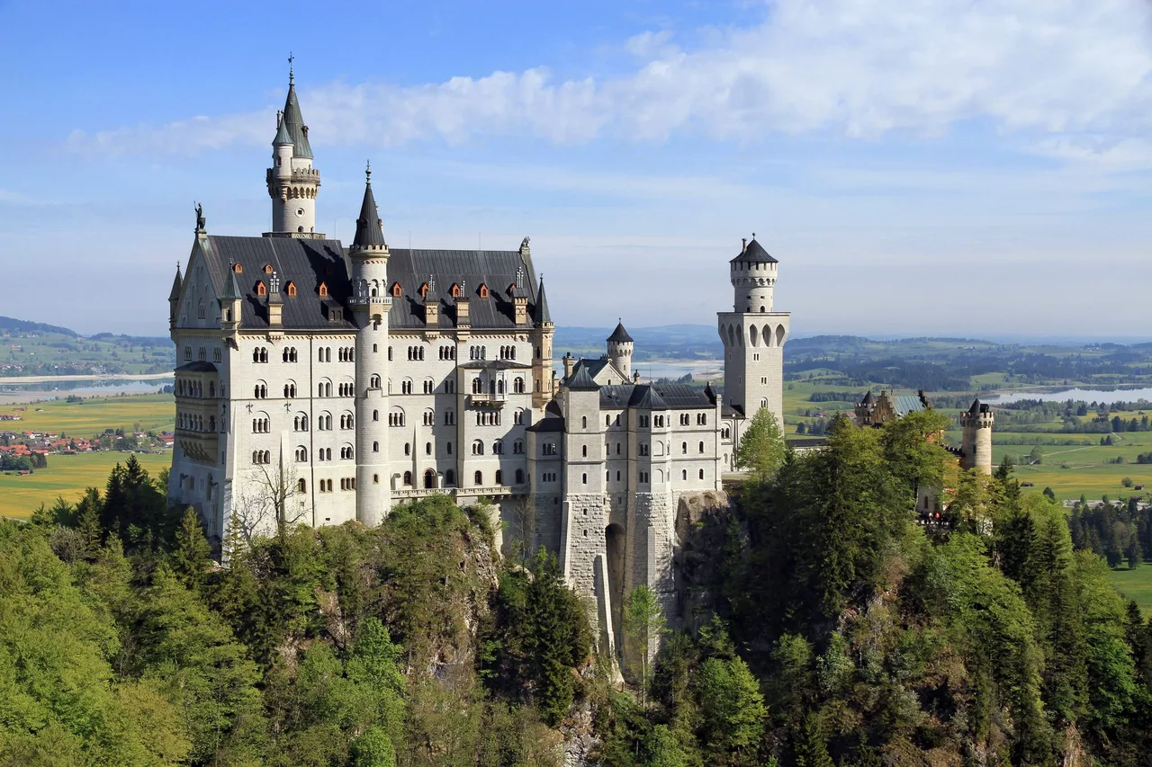
4. Neuschwanstein approach from Hohenschwangau (Bavaria)
What it is. The classic climb to the castle that Ludwig II began in 1869. The castle was meant as the king's private retreat, but it opened to paying visitors within about six weeks of his death in 1886, according to Wikipedia. Inside, it can only be visited on a guided tour. Outside, you can walk up to Marienbrücke for the view shown above.
Length and time. The ticket centre says that, from car park P4 below Hohenschwangau castle, the walk to the bridge takes about 45 minutes uphill. From the shuttle-bus stop it is 5 minutes to the bridge and 15 minutes to the castle. There is no single official distance for the whole approach.
Status. The castle is open for guided tours. Marienbrücke is a separate structure. It was closed from 2021 to July 2022 while rock anchors were replaced and was reopened on 28 July 2022. In winter, ice and snow can close it temporarily; the ticket centre's start page shows each day whether access is possible. The castle remains open when the bridge is closed.
Getting there. Shuttle buses run according to demand without a timetable and only in suitable weather. The ticket centre lists EUR 3.50 uphill and EUR 5.00 return per person. Buy castle tickets before riding up if you want to go inside, otherwise you must go back down to collect them. No bus on 24, 25 and 31 December and 1 January.
Rules and costs. No private photography or filming inside the castle. Prams, rucksacks and similar bulky items stay outside. Animals are not allowed in the castle. Drones are prohibited around the property.
Suits. First-time visitors who accept crowds, anyone who wants one of the most photographed views in Germany.
5. Neuschwanstein loop through the Pöllat gorge (Bavaria)
What it is. A shorter circuit that climbs through the Pöllat gorge to Marienbrücke and the castle. Popular listings call it a loop of about 4 km.
Status. Closed. The ticket centre states that the hiking trail through the Pöllat gorge is closed for safety reasons because of rockfall danger and that an opening date is not yet known. We checked this on 16 October 2026. Use the approach in entry 4 instead.
Suits. Nobody, until the trail reopens. Do not follow old route descriptions into the closed gorge.
6. Ravenna Gorge in the Black Forest (Baden-Württemberg)
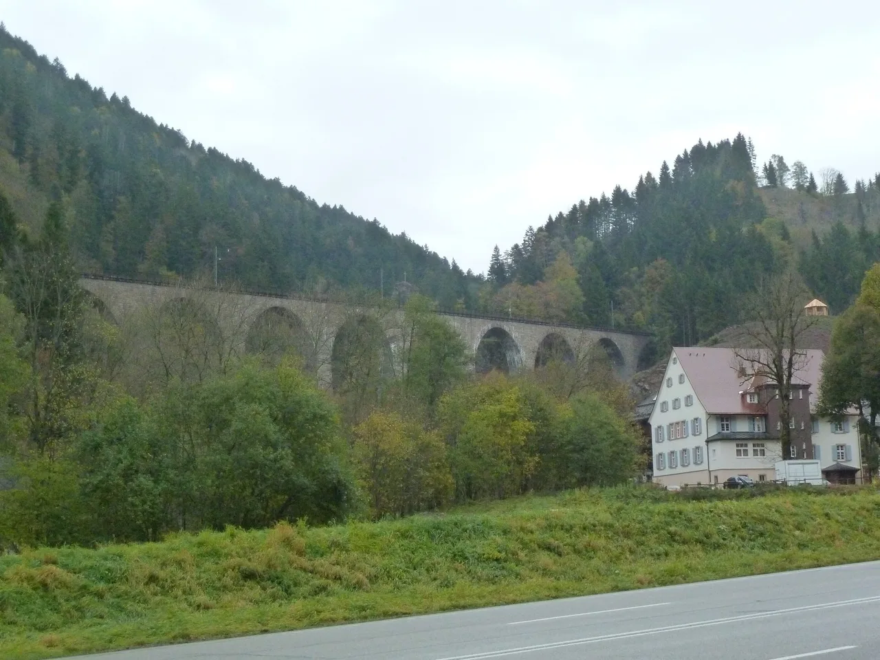
What it is. A winding gorge of about 4 km in the municipality of Breitnau, opening into the upper Höllental, where the Ravenna stream forms several waterfalls. The two largest are the Great Ravenna Fall (16 m) and the Small Ravenna Fall (6 m). The Heimatpfad Hochschwarzwald follows the gorge, partly over steps and rock galleries, past old mills. At the exit of the gorge the Höllental railway crosses on the Ravenna bridge, a nine-arch stone viaduct that is 36 m high and 224 m long and was inaugurated in December 1927.
Length and time. The gorge itself is about 4 km long. There is no official figure for a complete circuit, and circuits on the Heimatpfad vary widely with the start point, so decide that first: the parking by the gorge gives the shortest walk, Hinterzarten the longest.
Status. No closure notice was found on 16 October 2026. Steps, rock galleries and wooden boardwalks become slippery when wet and dangerous when icy, so we would not plan this walk for winter conditions. The Christmas market under the viaduct has been held on Advent weekends since 2010; regional press reports that the 2026 edition runs from 26 November to 20 December with advance tickets only and that these sold out within hours, so choose another date if you want the gorge to yourself.
Getting there. The Höllental railway stops at Hinterzarten, and a path leads through the Löffel valley to the gorge.
Rules and costs. No entry fee for the walk outside the market. Wear solid shoes.
Suits. Waterfall lovers, rail enthusiasts, shady summer walks.
7. Bastei bridge in Saxon Switzerland National Park (Saxony)
What it is. A sandstone bridge of seven arches and 76.5 m, built in 1851, which crosses a ravine between the rock formations of the Bastei high above the Elbe.
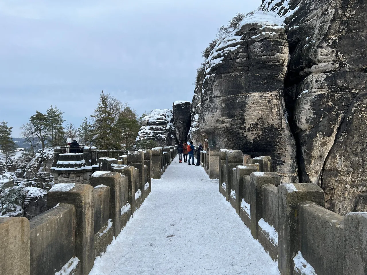
Length and time. From Kurort Rathen, the Basteiweg climbs to the bridge. No official figure is published for the walk from the car park, which is much shorter. Count on one to two hours including the viewpoints.
Status. Open. The regional tourism board states that the Basteiweg from Kurort Rathen via the Bastei Bridge is open. The same update reports that a storm at the end of July caused considerable damage around Rathen, that timber is still being cleared, and that only one of the two Gamrig car parks in Waltersdorf is open. It recommends that day visitors arrive via the left bank of the Elbe to Oberrathen by S-Bahn or by car as far as the Elbe car park and cross the river by ferry. Passenger steamer services were cancelled until 19 October because of low water.
Getting there. S-Bahn to Oberrathen and ferry across the Elbe, or bus to the Bastei car park.
Rules and costs. Dead or burnt trees can fall at any time in the national park; stay on marked paths, avoid the forest in storms or heavy rain, and do not light fires. The national park centre runs an information telephone, +49 35022 50240.
Suits. Views, photographers, short outings. Expect large crowds in the middle of the day, especially at weekends.
8. Schwedenlöcher to the Bastei (Saxony)
What it is. A narrow gorge of almost one kilometre, formed by erosion in the soft sandstone, with an iron-and-stone staircase system built in 1886. In 1967/68 it had 777 steps. Between 2021 and 2024 the metal and concrete fittings from the 1960s were renewed.
Status. Reopened. Several listings still show it as closed. On 16 October 2026 the regional tourism board stated that the Schwedenlöcher, the upper section of the Amselgrund, the Gansweg trail to the Schwedenlöcher and the Polenz valley near Waltersdorfer Mühle had reopened. The path has a history of rockfall closures, so look again on the day.
Length and time. No official figure found. Allow two to three hours for a walk that combines the gorge with the Bastei.
Rules and costs. As for entry 7. The route is steep, with many steps. Wikipedia reports up to 2,000 people a day in peak season, so go early.
Suits. Sure-footed walkers who like steps and narrow rock walls.
9. Medieval tour to Neurathen castle and the Schwedenlöcher (Saxony)
What it is. A circuit that adds the Neurathen rock castle at the Bastei to the Schwedenlöcher and the ferry at Rathen.
Status. Partly closed. The tourism board states that, because of security deficiencies, the Neurathen rock castle is closed until further notice and cannot be visited. The route over the Bastei Bridge is not affected, and the Schwedenlöcher are open. You can walk most of the circuit, but you cannot enter the castle.
Length, rules and costs. No official figure found for the combined tour. Rules as for entry 7.
Suits. Anyone who wants the full set of rock scenery and does not mind missing the castle visit.
10. Feldbergsteig in the Upper Black Forest (Baden-Württemberg)
What it is. A premium-certified circuit around and over the Feldberg, which at 1,493 m is the highest mountain in the Black Forest. It passes mountain huts and narrow paths and small bridges in a large nature reserve.
Length and time. Schwarzwald Tourismus gives 12.6 km, 4 h 30 min, 581 m of ascent and descent, between 1,107 m and 1,487 m of altitude.
Status. No closure notice was found on 16 October 2026. At this altitude the first snow may fall in late autumn, so check the weather and the conditions.
Getting there. Current bus times and parking rules for this trail are not listed here, so ask the Hochschwarzwald tourist information at the Feldberg before you go. A cable car, the Feldbergbahn, serves the upper station if you want to shorten the start.
Rules and costs. The area is a nature reserve. Stay on marked paths. Swimming in the Feldsee is forbidden.
Suits. Fit walkers who want a full day above the tree line without technical difficulty.
How to choose
- Short, easy and open: the Eibsee loop, or the Bastei bridge from the Elbe side.
- Wet-weather plan: the Partnach Gorge, with the warning about the closed path to Graseck.
- Waterfalls and railway history: the Ravenna Gorge, outside the Christmas market weeks and not in icy conditions.
- A full day on foot: the Feldbergsteig.
- Closed today: the Pöllat gorge loop and the Neurathen castle. Do not plan around them.
- Weekend crowds: go early to Neuschwanstein, the Bastei and the Schwedenlöcher, and expect queues for the shuttle bus.
Sources and verification date
Checked on 16 October 2026: Zugspitz Region Grainau (Eibsee data and transport), Partnachklamm GmbH (opening hours, prices, arrival, press notices), Wikipedia (Partnach Gorge, Neuschwanstein Castle, Schwedenlöcher), the ticket centre Hohenschwangau (Marienbrücke and Pöllat gorge), the Bavarian state portal (Marienbrücke repair and reopening), the Neuschwanstein castle site (visiting rules), the Saxon Switzerland tourism board (current news), the town of Hohnstein (Bastei bridge), Schwarzwald Tourismus (Feldbergsteig) Wikipedia (Ravenna Gorge and Ravenna bridge) and the Hochschwarzwald tourism pages (Ravenna Gorge, viaduct and Feldsee). Official sites change often; always check them on the day.
Related content
For another day out that combines forest and city, see From Vienna to the Vienna Woods: A Spring Walk Without Complicated Planning. The Austrian mountain route Kampalpe from Spital am Semmering: A Loop by Train shows the same approach on a mid-sized peak.