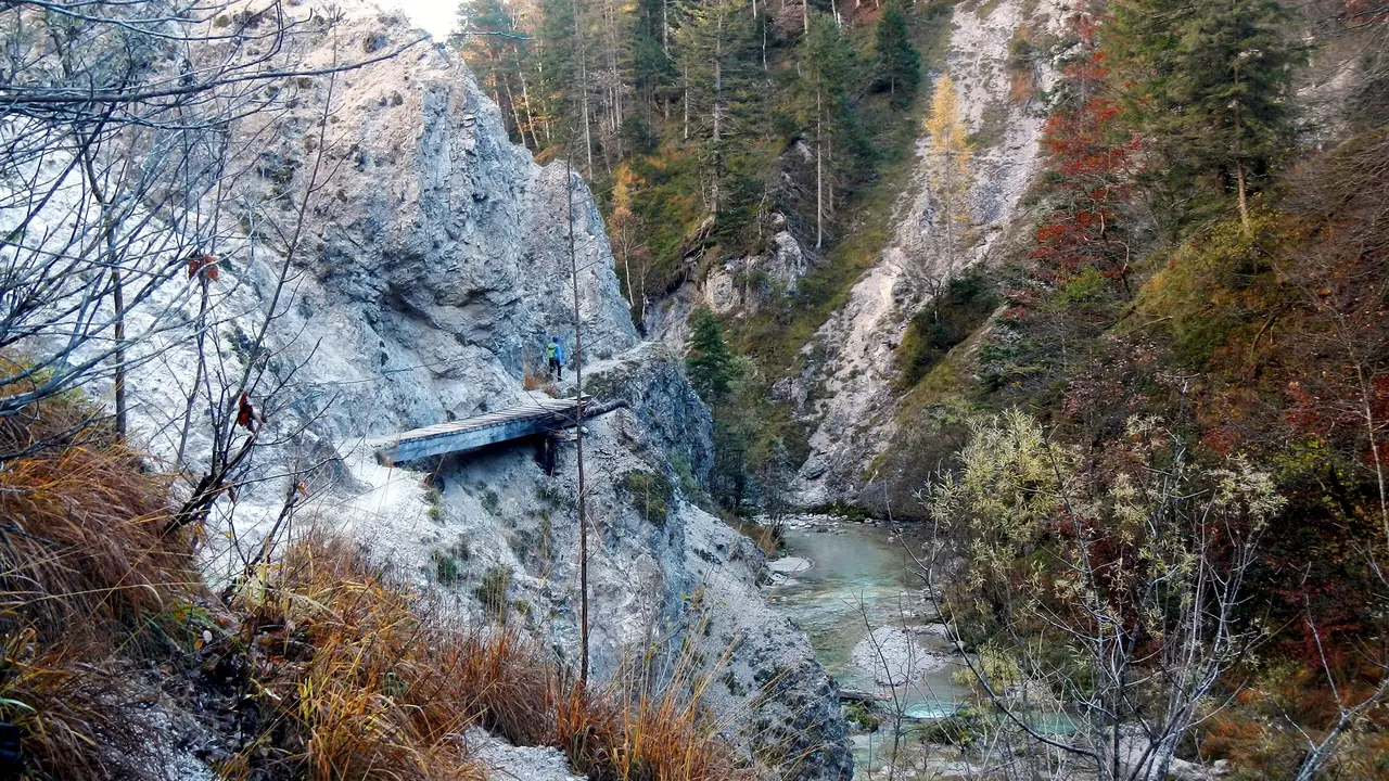
Two streams, an electric narrow-gauge railway and a nickname borrowed from Arizona explain most of what there is to know about the Ötschergräben. The nickname is "Grand Canyon of Austria", a name the people of the region gave to the deep cut that the Ötscherbach has made at the foot of the Ötscher mountain. The railway is the Mariazellerbahn, whose first power plant sits right at the mouth of the gorge. The streams are the Ötscherbach and the Lassingbach, and between them they decide what you see.
What the Ötschergräben actually are
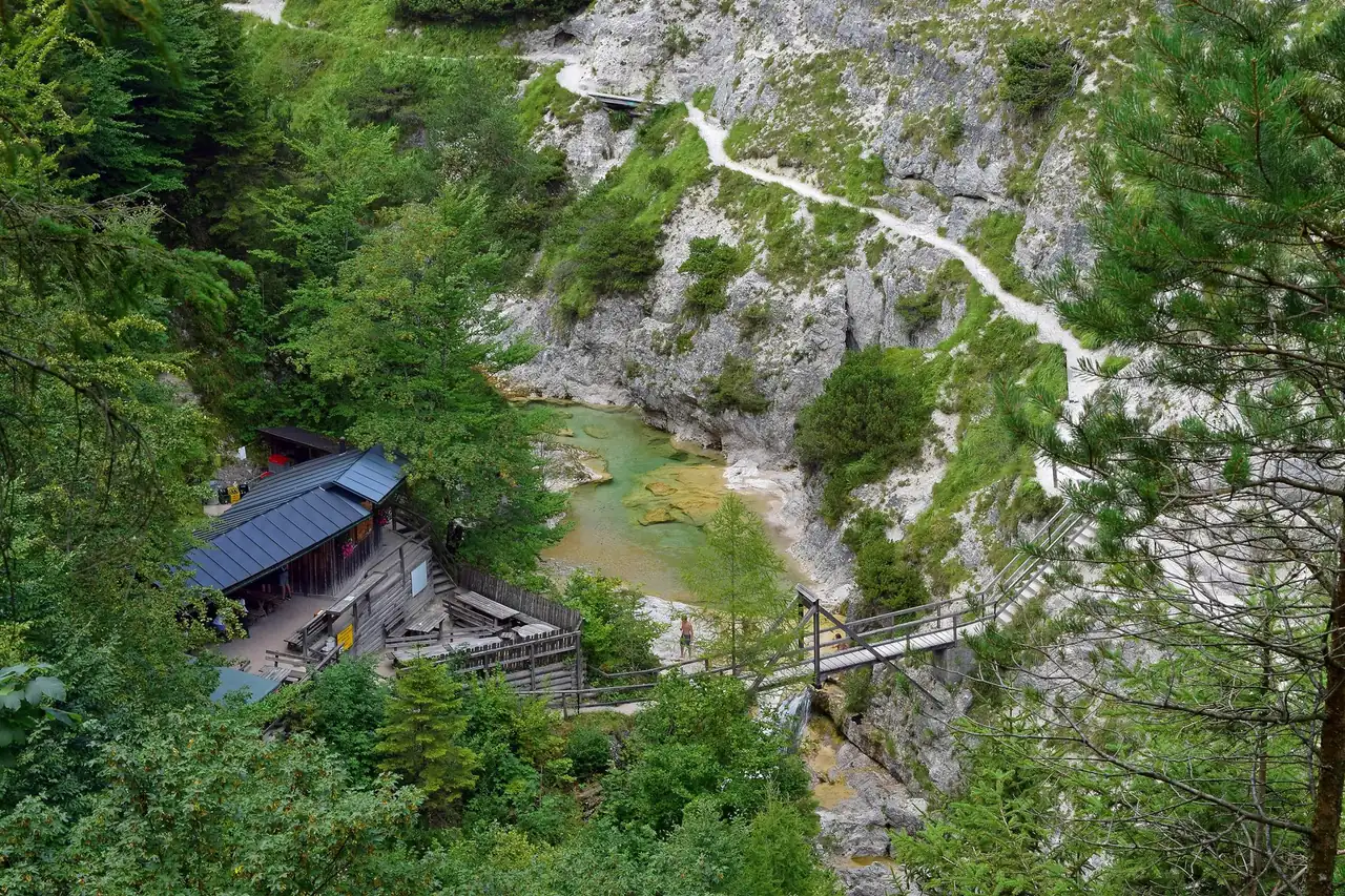
The Ötschergräben are a system of gorges in the Naturpark Ötscher-Tormäuer in southern Lower Austria. The Ötscherbach is about 9 km long. It rises at roughly 1,100 m on the south-western slope of the Ötscher (1,893 m) and joins the Erlauf at Stierwaschboden, at about 622 m. For the last stretch of that journey the stream runs through a deeply cut, canyon-like trench about 6 km long, which starts at the Schleierfall and ends at Stierwaschboden near the Wienerbruck power plant. The walkable path through the gorge is a little shorter, around 5.5 km according to the Austria Forum encyclopedia.
People usually say "Ötschergräben" in the plural, and with reason. Locals and guidebooks split the system in two:
- The Vordere Ötschergraben, between Stierwaschboden and the Jausenstation Ötscherhias, is the part that most day walkers see.
- The Hintere Ötschergraben lies beyond the Ötscherhias and holds the Mirafall and the Schleierfall. It is quieter and narrower, and it leads towards the Ötscher.
The park itself is large. The Naturpark Ötscher-Tormäuer covers about 170 km², which makes it the biggest of the 22 nature parks in Lower Austria. It was founded in 1970 after a protest movement against yet another hydropower plant on the Erlauf. That history matters later in this article.
The waterfalls, and why we give one height only
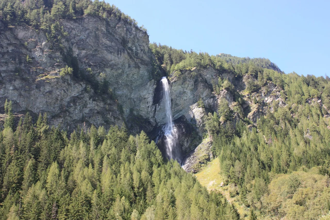
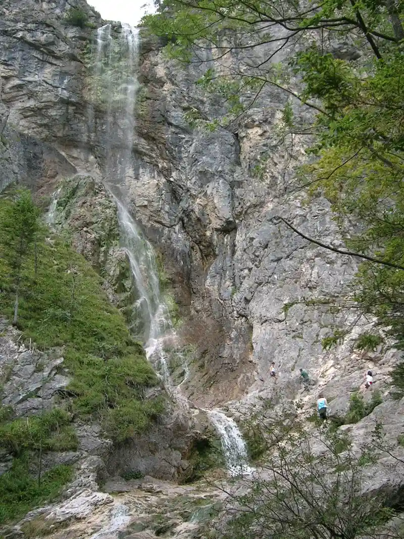
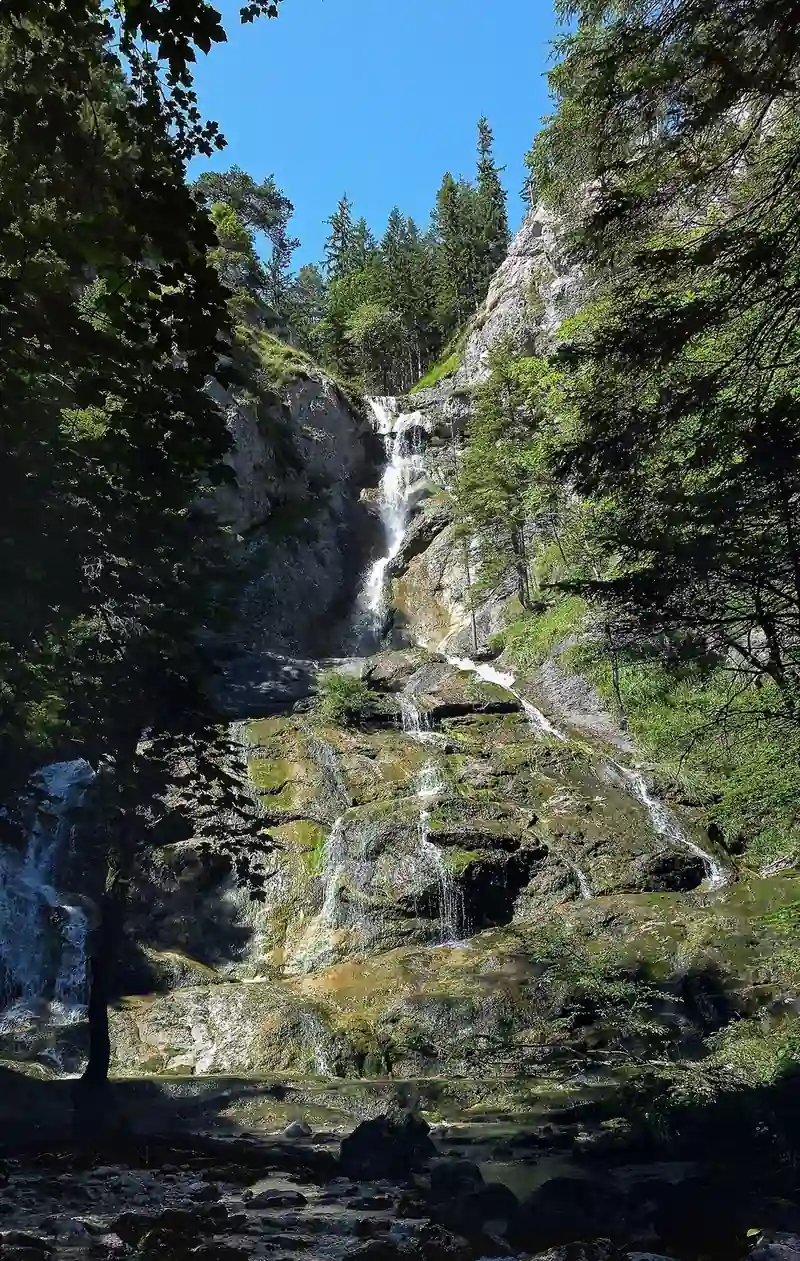
Three waterfalls dominate every description: the Lassingfall, the Mirafall and the Schleierfall. The tourism board calls them "up to 90 m" high, and the 90 m figure is exact for only one of them. Mostviertel Tourismus and the Wikipedia article on the Lassingbach both give about 90 m for the Lassingfall, which falls through the Lassing gorge between Wienerbruck and Stierwaschboden.
No official height is published for the Mirafall and the Schleierfall. Independent waterfall catalogues give clearly lower numbers than 90 m, but they are not official sources, so none are printed here. If you have read that the 90 m cascade is in the Ötschergräben proper, the more careful statement is that the 90 m belongs to the Lassingfall, which is reached from Wienerbruck as part of the same trail network.
Both of the deeper falls pour into the gorge from side valleys over the rock walls. The Schleierfall marks the beginning of the gorge. The Mirafall lies between the Schleierfall and the Ötscherhias. How much water they carry depends on rain and snowmelt, so a visit after wet weather or in spring tends to look best.
A railway that needed its own power plant
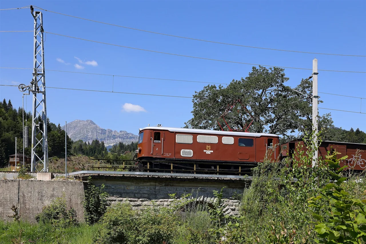
The Mariazellerbahn, the 760 mm narrow-gauge line between St. Pölten and Mariazell, was electrified in the early twentieth century, at a time when very few railways of that length ran on electricity. The line needed its own source of power, and the engineers found it in the Lassing valley.
The Kraftwerk Wienerbruck was built between 1908 and 1911 and started trial operation in 1910. The Lassingbach was dammed at Wienerbruck, which created the reservoir that is still there, and its water was led through a pressure tunnel with a drop of about 170 m to the plant at Stierwaschboden. The plant was designed and built under Eduard Engelmann junior. When it opened in 1911 it was the largest storage power plant in Austria-Hungary. It is the oldest power plant in Lower Austria and still belongs to the energy company EVN.
A second plant, Erlaufboden, followed in the 1920s. Since 2014 the railway has drawn its power mainly from other facilities, and the old railway-frequency machine in Wienerbruck stayed on as a reserve. It was switched off on 13 May 2025 after more than 114 years, and the plant now feeds only the public grid.
There is a direct effect on the landscape: because the Lassingbach is diverted, the Lassingfall carries less water than it would naturally. And there is a nice irony. The nature park was created in 1970 to stop the next power plant on the Erlauf, after the Wienerbruck and Erlaufboden plants had already been built.
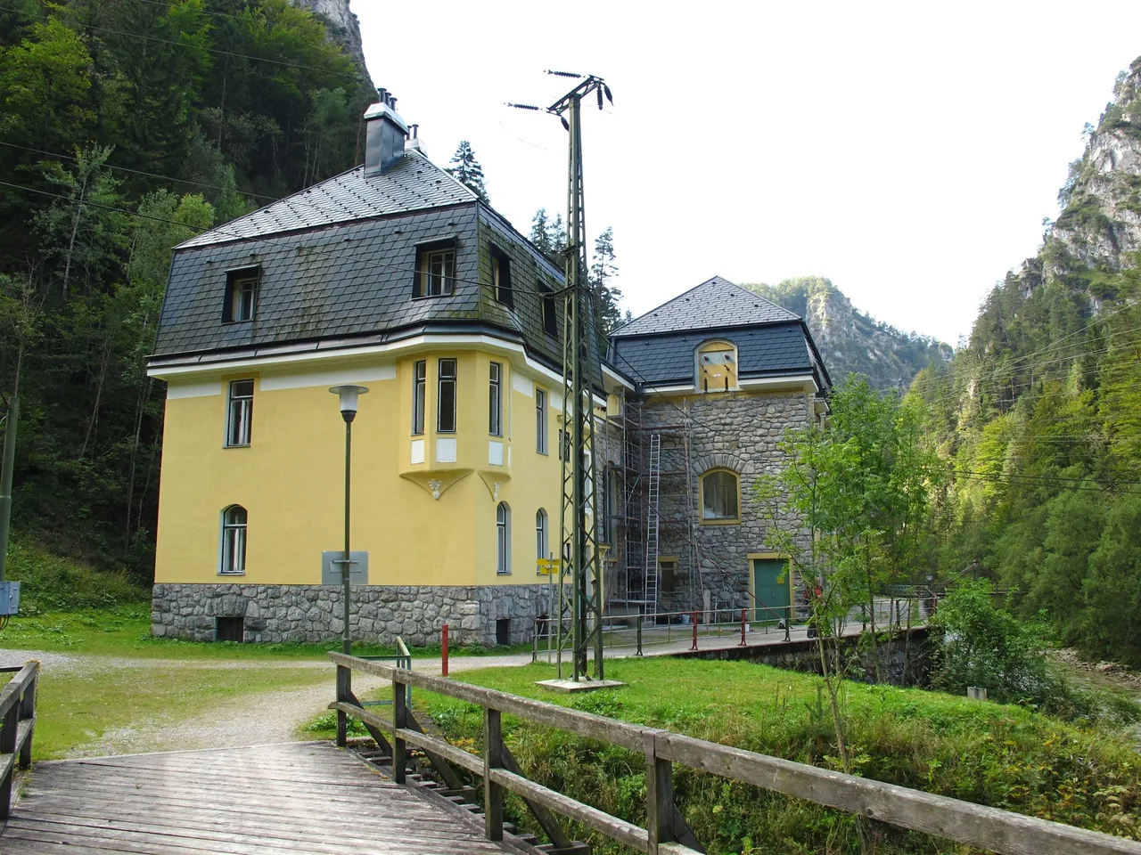
Walkers can see the building at Stierwaschboden, and since the 2015 provincial exhibition of Lower Austria the gallery in the machine hall has been open to visitors during the hiking season. The railway itself is now served by the modern "Himmelstreppe" trains, and the line runs along the edge of the park with five stops between Gösing and Mitterbach.
Four ways into the gorge
The Ötschergräben can be reached on foot only. Four approaches are in regular use, and the nature park and Mostviertel Tourismus publish tour tips for each of them.
- From Wienerbruck through the Lassing gorge, past the Lassingfall and the power plant, then up the Ötscherbach. This is the classic way in. The Wienerbruck, Ötschergräben, Vorderötscher, Erlaufklause tour is listed at 17.5 km and around 6 hours, and the shorter Wienerbruck to Erlaufklause walk at 8 km and about 3 hours.
- From Lackenhof over the Riffelsattel. The Lackenhof, Ötschergräben, Erlaufklause tour is listed at 14 km and about 5 hours. The Austria Forum describes a comfortable five-hour version that starts at the base station of the Ötscher chairlift, which carries walkers to the Ötscher-Schutzhaus at over 1,400 m.
- Down from the Ötscher summit via the Rauher Kamm, a rocky ridge with scrambling at grades 1 to 1+. The official tour page calls it steep, rocky and exposed, and says it demands sure-footedness and a head for heights. The circular tour from the Rauher Kamm through the deepest gorges is listed at 27.3 km and around 12 hours.
- From Erlaufboden through the Hintere Tormäuer, the Erlauf's own gorge, to Stierwaschboden. Mostviertel Tourismus describes the Gösing round through the Hintere Tormäuer, past the Lassingfall and back to Wienerbruck at 8.5 km and 3.5 hours, with the train back to the start.
A longer classic links Gösing station through the Hintere Tormäuer and the Ötschergräben to Mitterbach: 14.8 km, about 4 hours 50 minutes, with about 358 m of climbing and 459 m of descent according to the official page.
The gentler cousin of all these is the walk we describe in the separate route article, from Wienerbruck to Mitterbach: it uses the Lassing gorge and the front of the Ötscherbach gorge and ends at the Erlaufstausee. It is about 11 km and moderate. The deeper Hintere Ötschergraben is a different day.
Plants and wildlife
The park's description is dry but interesting. Because the gorge is cool and shaded, plants that normally grow only above 1,000 m in the Alps, such as alpenrose and gentian, are found here between 500 and 1,000 m, according to the Austria Forum. The park also lists daphne, orchids and gentians among its rarer plants, typical of the northern limestone Alps.
For caves, the park names the Ötscher-Tropfsteinhöhle, the Taubenloch and the Geldloch. The last two lie on the path from the Mirafall up towards the Ötscher.
Planning notes
- Season: the park says the Ötschergräben and the Hintere Tormäuer are open to walkers until the end of October and that the annual winter closure starts on 2 November. The rest of the park stays open all year. This was the status on 16 October 2026.
- Entry: the nature park charges entry at its gates, 5 EUR for adults and 2 EUR for children aged 6 to 14. Entrances include Wienerbruck, the Erlaufstausee, Erlaufboden and Lackenhof. A combined ticket with the Mariazellerbahn exists.
- Parking: paid. The park lists 6 EUR for a car per day.
- Trains: the Mariazellerbahn announces replacement buses between St. Pölten Hbf and Mariazell from 2 to 20 November 2026.
- Refreshments: the Jausenstation Ötscherhias is on the path. The Ötscher-Basis in Wienerbruck has a regional kitchen that is open Friday to Sunday and on public holidays in September and October 2026.
- Overnight: the Schutzhaus Vorderötscher lies at the head of the gorge between the Gemeindealpe and the Ötscher. It has 20 beds and 20 places in a dormitory and can be used with advance booking, according to Wikipedia. Confirm current details before relying on it.
- Dogs: allowed on a lead.
- Safety: stay on the marked paths and behind barriers. Be careful with wet rock. The Rauher Kamm is a mountain route, not a gorge stroll.
Sources and verification date
We checked the facts on 16 October 2026 against the Naturpark Ötscher-Tormäuer (fees, access, closures, tour tips), Mostviertel Tourismus (tour data, waterfall heights), the Mariazellerbahn site, the Austria Forum encyclopedia, and the German Wikipedia articles on the Ötscherbach, the Lassingbach, the Kraftwerk Wienerbruck, the Mariazellerbahn and the nature park. Official pages differ slightly on some distances and times. Where they do, we gave the figure from the page that names the route most precisely.
Related content
- Wienerbruck to Mitterbach: A Gorge Walk Past the Lassingfall: a step-by-step route description with the Lassingfall and the Erlaufstausee.
- Thayatal National Park: Austria's Smallest Wild Valley: another protected river valley in Lower Austria.