Two faces of one national park
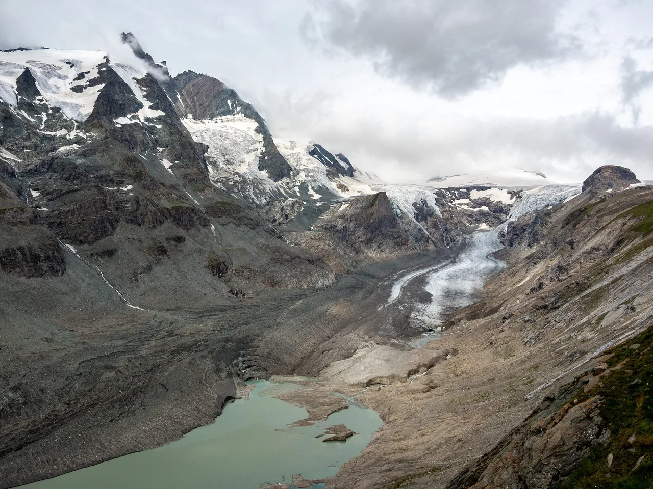
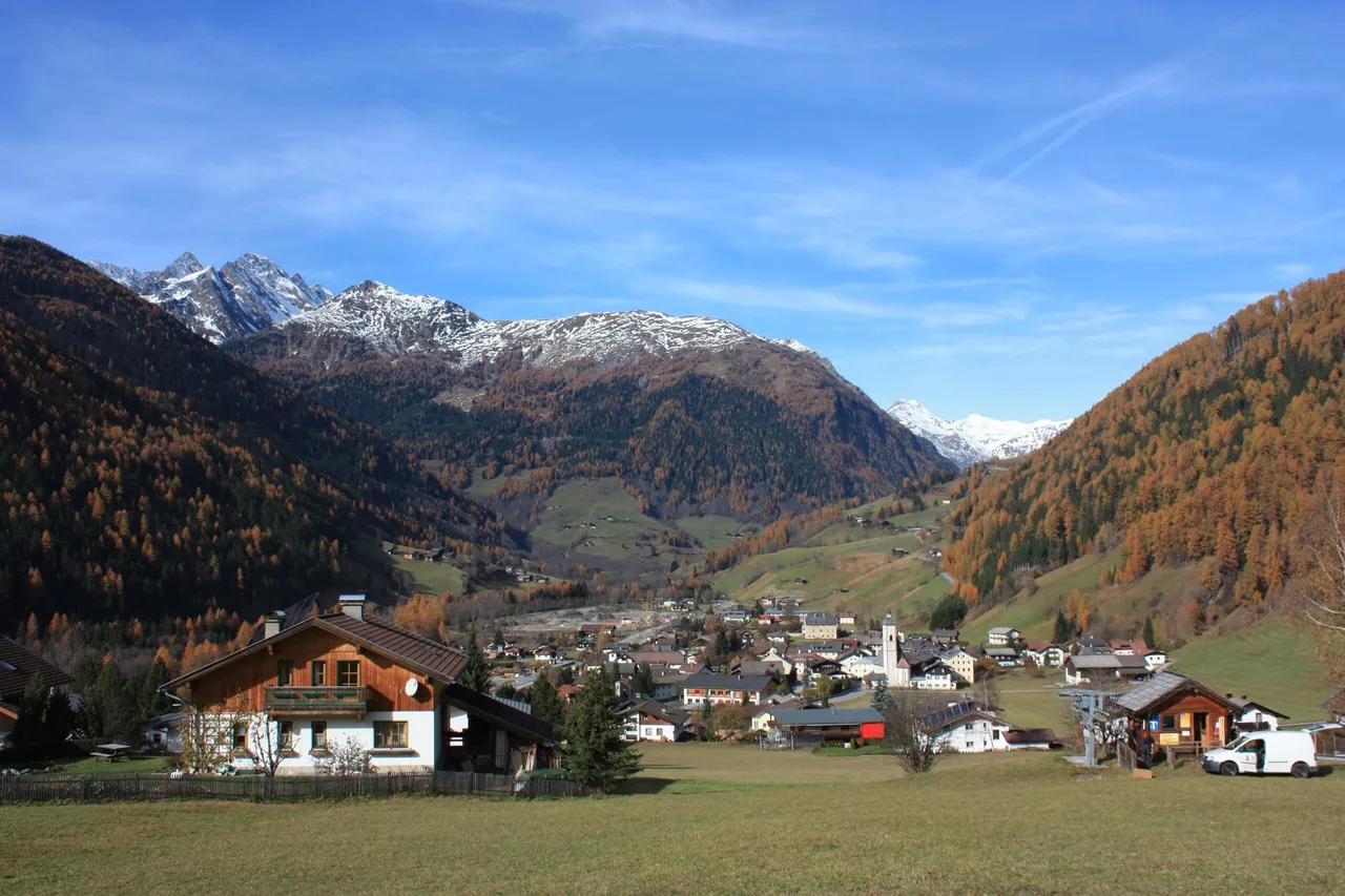
The Hohe Tauern National Park is known for ice and rock, and for the Großglockner, Austria's highest mountain. This walk shows another side of it. It runs down the upper Mölltal in Carinthia, from the mountain village of Heiligenblut to Döllach in the municipality of Großkirchheim, and on the way it passes farmland where grain was once grown on steep sunny slopes, a row of water mills built on wooden stilts, one of the park's showpiece waterfalls, and a valley whose wealth once came from gold. It suits walkers who like a day with a story in every village, who are happy with a long point-to-point walk, and who do not mind a bus ride at either end.
The walk is described as a chain of stops rather than a single measured line. The stops, their facts and the distances are checked, but the path between them is yours to choose with a good map. In short: Heiligenblut at the top, the Jungfernsprung waterfall and the village of Apriach with its mills in the middle, Döllach at the bottom, and about 13 km of valley and mountain slope in between.
Key parameters
- Length: about 12.8 km from Heiligenblut to Döllach. This is a calculation on OpenStreetMap footpaths by the shortest walking route, not a surveyed track. Detours to the mills or the waterfall add to it.
- Height: Heiligenblut village centre lies at 1,291 m, and the climate station in Döllach at 1,071 m. The valley floor therefore drops by roughly 220 m overall, with extra climbing if you visit Apriach, which sits at about 1,500 m according to a regional source.
- Time and difficulty: there is no verified walking time for the whole line. It is classed as moderate because of the distance and the optional climbs. The park's own Jungfernsprung circuit is rated easy, with a climb of about 30 minutes to the base of the falls.
Start and finish
The start is Heiligenblut am Großglockner, at the top of the Mölltal. The main village, called Hof, has its church at 1,291 m. OpenStreetMap places the village at about 47.0385 N, 12.8408 E. The finish is Döllach, the main village of Großkirchheim, at about 46.9735 N, 12.8970 E.
One detail worth knowing: Apriach, the mill village, belongs to the municipality of Heiligenblut, not Großkirchheim. It is a hamlet on the sunny slope above the valley, about 127 people live there, and it appears in the park's regulation as its own cadastral community.
How to get there
Heiligenblut has no railway station. The nearest ones are Lienz, Mallnitz and Spittal an der Drau. From any of them you continue by regional bus along the Großglockner road, the B107. The national park's own page for the waterfall mentions that the site can be reached by regular bus, with details at postbus.at, and the Kärntner Linien timetable portal covers the line numbers and hours. Please look up the line number and times for your date.
If you come by car, note that the Großglockner High Alpine Road from the north is open only from early May to early November, depending on weather. Heiligenblut is reachable from the south all year, which means a trip from Salzburg in winter has to go round via Lienz.
For a one-way walk, you have two choices. Leave the car at the finish and take the bus up, or take the bus down at the end and collect the car later. Both work, but plan the last bus carefully.
Route description
Heiligenblut and the first stretch
Start at the church. The parish church of Saint Vincent was built between 1460 and 1491 and has a legend attached to it: a vial with the blood of Christ, said to have been carried here by a Danish prince around the year 914. The name Heiligenblut, "holy blood", comes from this story. Whether or not you believe it, it gives the village its character, and the church is worth ten minutes before you set off.
Then head south, down the valley. The first villages on the way, such as Pockhorn and Aichhorn, belong to Heiligenblut. Your goal for the first part is the Jungfernsprung.
The Jungfernsprung waterfall
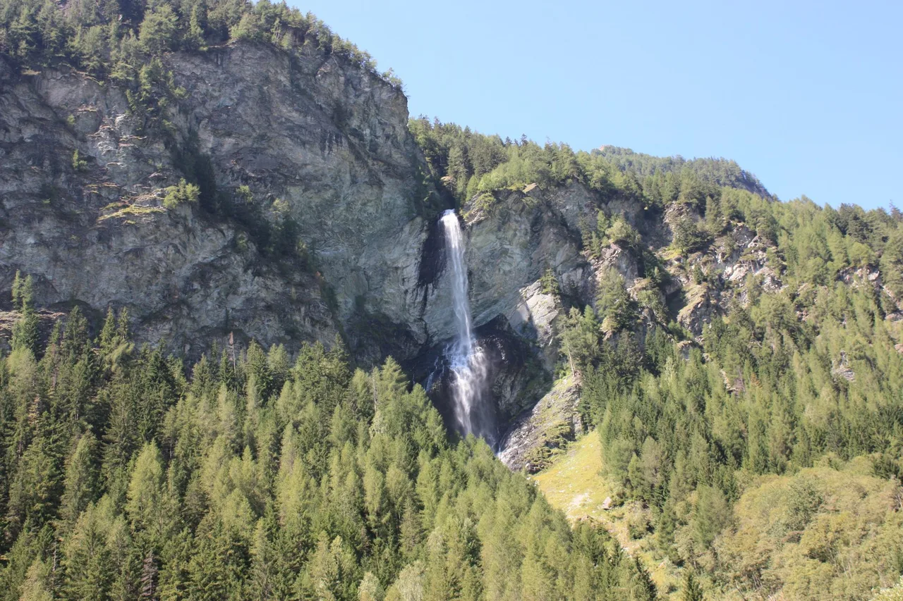
The brook that makes this waterfall is the Zopenitz brook. Its small valley opens into the Mölltal over a rock step about 250 m high. The park describes a drop of 120 m over a rough wall, and the regional Nationalpark-Region website speaks of 130 m, so the honest answer is "between 120 and 130 m", depending on where you measure and how you count the cascades. The park says two cascades, the regional site three. The park itself calls it one of the most beautiful waterfalls in the national park.
The legend is simple. A young woman was running away, and she jumped from the rock to escape. Angels carried her, and she survived. The park's description says she was fleeing an overbearing hunter; the regional tourism site says the devil. Local stories travel in more than one version, and we leave both here.
The park maintains a circuit called the Wasser Wunder Weg Jungfernsprung. It is a round walk of about 2 km, around one hour, rated easy. After a climb of about half an hour you reach a rock platform at the foot of the falls, where, with some luck, you can see a rainbow in the spray. There is a car park directly on the main road, and the park says it can be reached by regular bus.
Apriach and the water mills
Apriach lies on the sunny slope above the valley. Until a few decades ago, grain was grown here at about 1,500 m, which is unusually high, and farmers had to use hardy varieties for that reason. Almost every farm had its own mill on the Apriacher Bach.
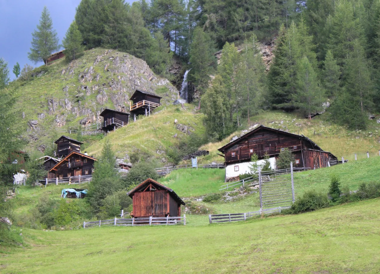
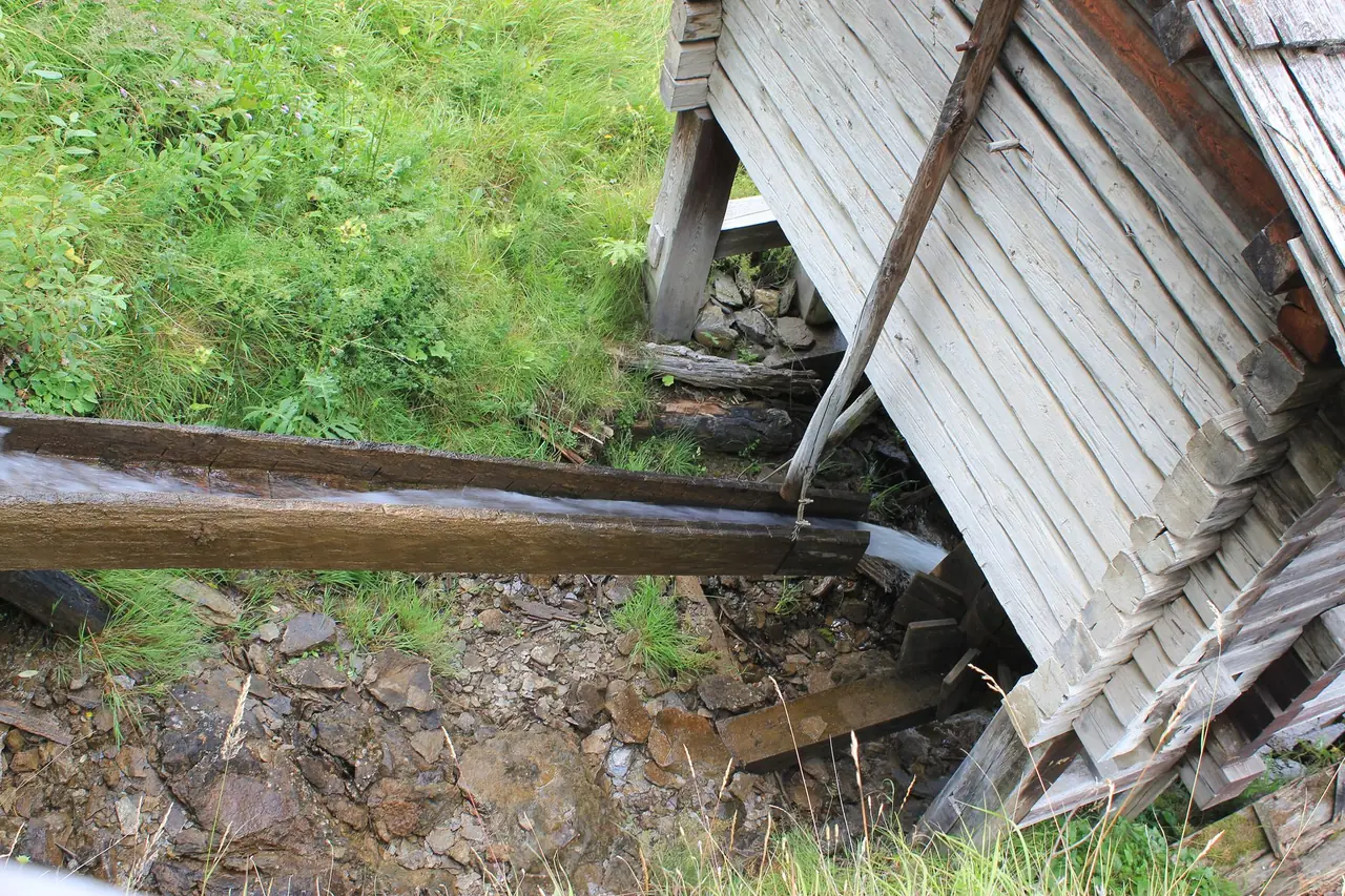
Eight of those mills survive as one ensemble. They are called Stockmühlen, because the vertical wooden axle that drives the millstone is known locally as the "Stock". Each mill stands on tall wooden supports, high above the ground. The stream passes from the wheel of one mill to the next, so that all of them can run at the same time. The channels and wheels are made of larch and the millstones of soft granite. The oldest buildings date at the latest to the eighteenth century, and one carries the year 1792. An association of mill owners was founded in 1976, and the Federal Monuments Office placed the ensemble under protection in 1983.
You do not need to know how a horizontal water wheel works to enjoy the place. It is a quiet, sloping meadow, and the wood has a grey and weathered look. The Alpe-Adria-Trail passes the mills, according to the Heiligenblut tourism site, which describes them as a cultural monument along the way.
Down to Döllach and the gold
From Apriach, the route returns to the valley floor and follows the Möll and the road south to Döllach. The last part is the least dramatic, so use it to think about what you have just seen.
Gold is the thread running through this valley. The municipality of Großkirchheim says that Tauern gold drew people to the high mountains early on, and that it made Großkirchheim one of the most important places in the Mölltal in the sixteenth century. According to Wikipedia, gold was mined in the Hohe Tauern in Celtic and Roman times, with a first great period in the Middle Ages and a second from the late fifteenth century. A document from 1338 granted mining rights in the Kirchheim court. In the municipal area, digging lasted into the seventeenth century, and ended when the advancing Pasterze glacier iced over more and more of the pits. In Heiligenblut itself, gold was mined into the twentieth century.
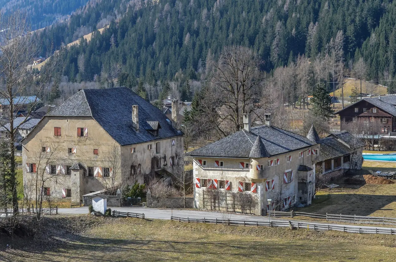
Döllach was the centre of this business. The municipality describes it as the seat of the mining entrepreneurs, the place where gold was processed, and the seat of the lordship and local office. Today the main village still has Schloss Großkirchheim and the small castle next to it, first mentioned around 1140 to 1150, and the Putzenhof, where the exhibition "Mythos Gold" tells the story of Tauern gold.
Döllach is also the base of the Carinthian national park administration. Wikipedia describes Großkirchheim as the seat of the park's office, OpenStreetMap places the administration near the Döllach bus stop, and the park's Carinthian phone number carries the local area code 04825, which belongs to Großkirchheim. So the claim that the park is administered from here holds up.
Map and track
There is no GPX file or route map, because the line described here is a sequence of verified stops rather than one measured track. For the Jungfernsprung circuit, use the park's information and the signs on site. For the rest, use a current hiking map or app, and check that the paths are open.
Seasons and safety
The Mölltal is a high valley. Heiligenblut is at 1,291 m, and Apriach is higher still. Snow lies late on the slopes in spring and returns early in autumn, so for the upper section we suggest early summer to autumn. Snow dates vary from year to year; check local conditions before you go.
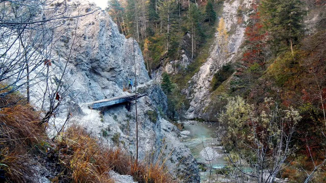
The valley path is not technical, and the Alpe-Adria-Trail organisers describe their route in general as easy to moderate, without exposed or rope-secured stretches. Mountain weather still matters. Afternoon thunderstorms are possible in summer, and the area around the waterfall is wet and slippery. Do not leave the signed path near the falls, and keep children close at the rock platform.
Gold history sometimes tempts visitors toward old mine entrances. Do not enter them. They are unmaintained and dangerous, and the proper way to learn about mining is the exhibition.
Practical recommendations
Water and food: carry water. There are inns in Heiligenblut and Döllach, but opening hours vary, so bring a snack.
Footwear: walking shoes or light boots with good grip. The waterfall circuit and the slope at Apriach can be damp.
Gold panning: the Via Aurea project, which presents the Tauern gold routes, says guided panning is offered in the region. The sources name no specific panning spot on this route, so ask at the park or at the Putzenhof before planning around it.
Dogs and restrictions: you are in a national park, so follow the signs and stay on paths. On the Alpe-Adria-Trail, dogs must be kept on a lead, according to its organisers, and we suggest doing the same here.
Accessibility: the Jungfernsprung circuit includes a climb on paths, and the Apriach slope is steep. Neither suits wheelchairs.
Alternatives and shortcuts: if you want a short outing, walk only the Wasser Wunder Weg and take the bus back. If you prefer a flatter day, walk the valley from Heiligenblut to Döllach without climbing to Apriach.
Sources and verification date
Checked on 16 October 2026: the Hohe Tauern National Park pages for the Jungfernsprung circuit and for contacts; the Nationalpark-Region Hohe Tauern Kärnten page on gorges and waterfalls; the Großkirchheim municipal website; the Heiligenblut tourism page on the Alpe-Adria-Trail; the Alpe-Adria-Trail pages on the trail and its questions and answers; the Austria-Forum entry on the Apriach mills; German Wikipedia on Heiligenblut and Großkirchheim; English Wikipedia on the national park; OpenStreetMap for coordinates and walking distances. Third-party bus line numbers and any specific gold panning site could not be verified and are not stated as fact.
Related routes
For another Carinthian lake day, see Bleistätter Moor to Feldkirchen or Ossiach Ravine Trail and Tauernsee. Both are far lower in altitude and a good contrast to the high valley.