A wetland that was given back
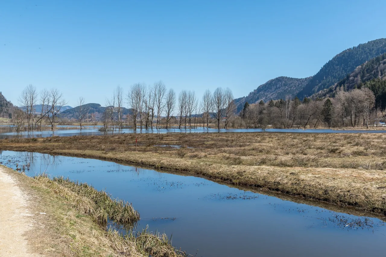
Most spring walks start with a view. This one starts with a story about water. At the eastern end of Lake Ossiach, a large moor was drained for farmland in the 1930s, and in recent years part of it has been flooded again. You can walk through the result in an hour or two, and then keep going along a river and across farmland to the town of Feldkirchen. The whole route comes to roughly twelve kilometres, mostly flat, with a few short climbs, and it suits anyone who likes birds, quiet lanes and a bakery stop at the end.
We made the trip on a spring day. From Villach the bus took about half an hour and dropped us right at the start. We saw swans nesting at the shore, herons, thrushes and reed warblers in the reeds, a woodpecker, storks and starlings. After the moor we followed signs towards Feldkirchen: fields along a river, farms, pastures with cows and blossoming trees, and a handful of climbs. In Feldkirchen we had coffee and a fresh croissant on a lawn full of dandelions. That is the whole plot, and it is a good one.
Key parameters
- Length: about 12 km. This is a planning figure from the walk and from OpenStreetMap paths, not a surveyed track. A direct route from the moor to Feldkirchen is closer to 9 km, and a longer variant that stays close to the river comes out near 13 km.
- Time: allow three to four hours at a relaxed pace, plus time for birds. This is a planning estimate, not a measured duration.
- Height: the moor sits at about 502 to 510 m. The climbs are short and few.
- Difficulty: easy. The official Slow Trail inside the moor is rated easy, and the onward part is on lanes and field paths.
The Slow Trail Bleistätter Moor itself, which circles the restored area, is a separate official walk of 7.25 km with a walking time of about two hours and almost no climbing (17 m up, 13 m down).
Start and finish
The start is on the edge of the Bleistätter Moor near Steindorf am Ossiacher See, on the eastern shore of the lake. OpenStreetMap puts the centre of Steindorf at about 46.6981 N, 14.0090 E, and the moor itself at about 46.6922 N, 14.0201 E. We got off the bus directly at the start. If you arrive in Steindorf instead, the moor is a short walk away: calculated on OpenStreetMap paths, the distance is about 1.3 km.
The finish is the town centre of Feldkirchen in Kärnten, the district capital.
How to get there
You will most likely come via Villach, the rail hub of the region. The regional tourism board lists the bus lines to the lake in its 2026 mobility overview: lines 360, 361 and 40 run Villach, Landskron, Ossiach and Steindorf. In our case the ride from Villach to the moor took roughly 30 minutes. Timetables and seasonal changes are on the Kärntner Linien portal, and it is worth checking them the evening before.
The board also offers an on-demand Postbus shuttle in the municipalities of Steindorf and Ossiach, which can bring you to hiking starts. If you drive, Steindorf is reached from the A10 Tauern motorway exit Villach-Ossiacher See via the B94 towards Feldkirchen, as the official Slow Trail page describes.
For the way back, Feldkirchen has a railway station and a bus station. Line numbers and times are not listed here. Look up your return on the day, particularly on Sundays and public holidays.
The moor in a few honest facts
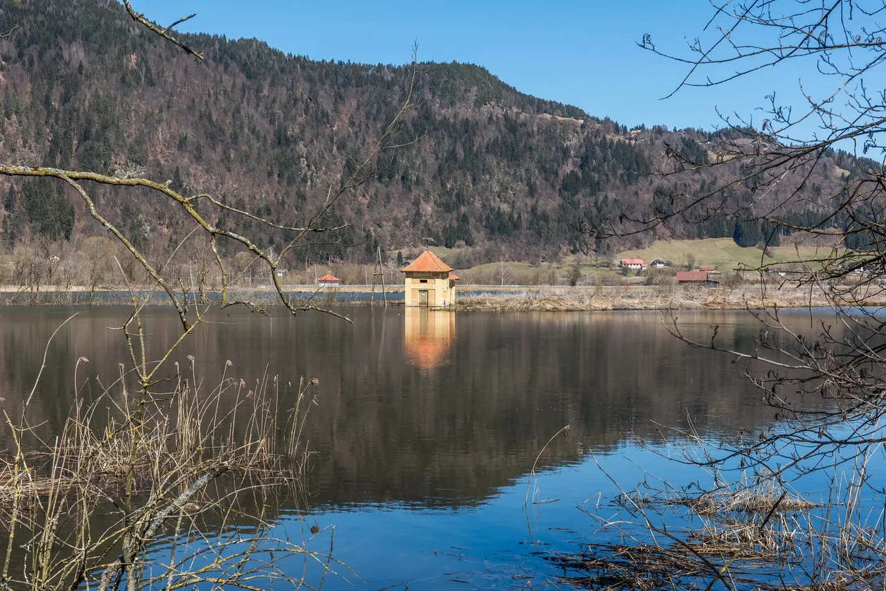
The tourism board states that the Bleistätter Moor was once one of the largest moorland areas in Carinthia, at around 600 to 650 hectares, and that it was drained for agriculture in the 1930s. Other sources give a larger area, up to 700 hectares, and a drainage period running from 1930 to 1961. A pump house that carries the year 1931 still stands in the water, and it is a good way to picture what the place used to be: a landscape kept dry by machines.
After decades of renaturalisation work, large parts were flooded again from 2016, according to the board. Wikipedia gives 2018 for the flooding of a part of the moor, and says the aim was to improve the water quality of the lake. Because the two sources differ, we only say that the flooding happened in the second half of the 2010s, which makes it a recent change.
The restored area belongs to the European protected area Tiebelmündung, which the Carinthian state government created by ordinance in 2010. It forms part of the Natura 2000 network and covers about 101.7 hectares, a small part of what the moor once was. That also answers the question many visitors ask: the moor you walk through is not huge. Its value lies in what it does for the lake and for wildlife. The tourism board describes sedimentation basins that work as natural filters and improve the water quality of the lake.
On the birds, the sources disagree. One official page on the Slow Trail speaks of the habitat of about 100 bird species. Another, on the moor itself, says that over 200 species can be observed, and names cranes, kingfishers and black storks. Counts depend on how rare visitors are treated, and the safest statement is that the wetland attracts a large number of species. The same page mentions 31 dragonfly species and 14 bat species, and the Slow Trail page adds butterflies and beavers.
Route description
Through the moor
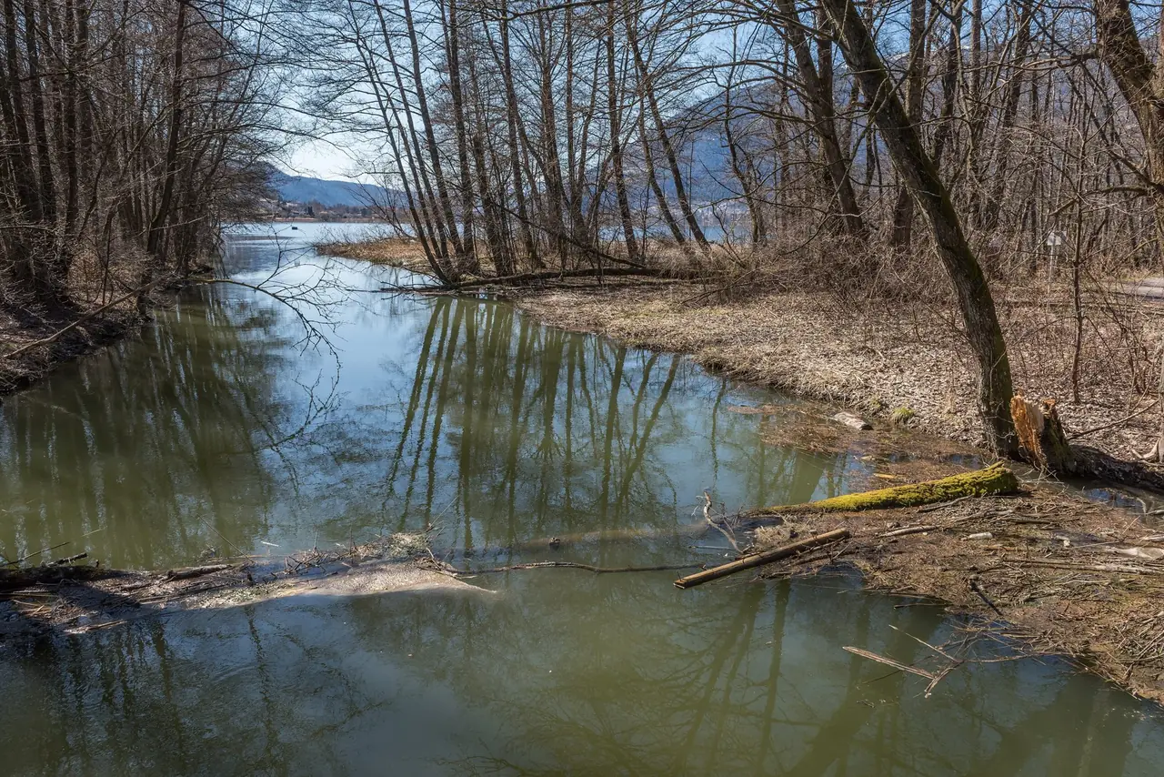
Start on the dam paths that cross the flooded meadows. The surface is compacted gravel and earth, and in spring the water stands close to the path on both sides. Rows of bare poplars rise out of shallow pools. There are benches and viewing platforms, so you can stop and listen. The reeds are loud in spring with warblers, and the shore is where we saw the swans on their nest. Keep your voice low: noise is restricted in the protected area, as you will see below.
Along the Tiebel
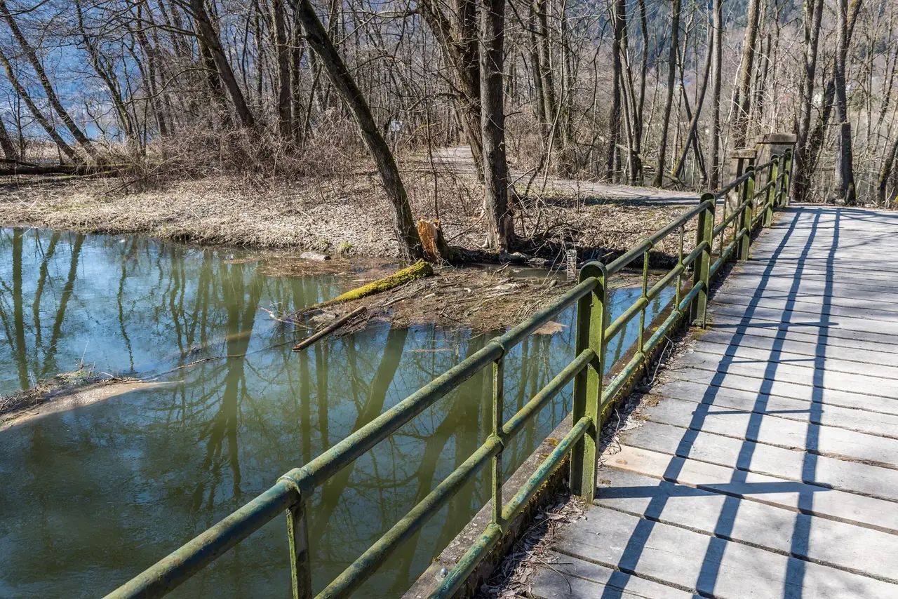
The river that feeds the moor is the Tiebel. It rises near Himmelberg, flows through Feldkirchen, and then enters the lake at the moor. According to Wikipedia its spring area is the second largest in Carinthia. The river runs straightened and embanked along the moor, and that gives you an easy line to follow: with signs for Feldkirchen, the lanes and field paths run beside it for a good stretch. A local legend, which Wikipedia retells, says that the Tiebel flows "uphill" towards the lake, which is why a medieval penitent king was supposed to have found rest here. It is a legend, not history.
Farmland to the town
After the moor the character changes. You pass fields, farms and pastures with cows, and in spring there are blossoming trees along the way. The route has a few climbs. None is long, but with a day pack they are noticeable, and cyclists will find the same lanes comfortable. Keep to the signed route and to the edge of fields: this is working farmland.
The final stretch leads into Feldkirchen. We chose a lawn with dandelions and a bakery coffee. That small detail is part of the plan, so leave time for it.
Map and track
There is no GPX file or route map for this walk, and the distances above are estimates from OpenStreetMap paths. The tourism board publishes its own map of the Slow Trail Bleistätter Moor; use that for the moor loop and a current map or app for the onward lanes.
Seasons and safety
Spring is when we walked, and it is a good time: bare trees show the open water, and birds are active. The board lists guided birdwatching tours in the moor between 2 April and 27 October, on Tuesdays and Thursdays from 9:00 to 11:30 and on Sundays from 9:30 to 12:00. They are free, binoculars are provided, and they run from four people with registration. The page we checked did not show a year, so confirm the dates before you plan around them.
Water levels change with rain and snow melt, and the paths can be wet or muddy. The route is flat and without exposed sections. Practical risks are the usual ones for a long day on lanes: sun, rain, and traffic where the route crosses or follows roads. Wear something visible near roads.
Rules in the protected area
The state ordinance for the Tiebelmündung protected area sets clear limits, and they matter for a walk like this. Among other things, it forbids:
- bringing dogs that are not on a lead;
- leaving the paths to enter reeds, moor or marsh areas;
- camping and pitching tents, and parking caravans;
- boating of any kind, and building piers or platforms;
- disturbing animals, including noise from radios and similar devices;
- flying drones or other aircraft lower than 300 m above the ground;
- spreading fertiliser or pesticides.
Photos are fine, but stay on the paths. The ordinance applies to the whole area, so these rules also bind anyone who visits it on a bike.
Practical recommendations
Water and food: take water with you. Steindorf and Feldkirchen have places to eat, but opening hours vary, so do not count on a particular one.
Footwear: sturdy walking shoes or light boots. In spring the dam paths can be damp.
Binoculars are worth carrying. The tourism board lends them on its guided tours, but not on an ordinary day.
Accessibility: the board rates the Slow Trail in the moor as easy, with almost no climbing. Full wheelchair access for the whole route is not confirmed. The onward lanes have a few climbs, which a pushchair can manage but a wheelchair may find tiring.
Alternatives: if twelve kilometres feels like too much, walk only the Slow Trail loop and return by the bus. If you prefer to skip the moor, take the bus directly towards Feldkirchen. If you want a more strenuous forest day on the same lake, try Ossiach Ravine Trail and Tauernsee.
Sources and verification date
Checked on 16 October 2026: the regional tourism board pages on the Bleistätter Moor, the Slow Trail Bleistätter Moor (Variant A), mobility in the region and the Lake Ossiach trail; the Carinthian ordinance on the European protected area Tiebelmündung (LGBl 94/2010) in the federal legal information system; the list of European protected areas in Carinthia and the article on the Tiebel river on German Wikipedia; English Wikipedia on Lake Ossiach; the Wikimedia Commons description of the pump house photo; OpenStreetMap for coordinates and path distances. Details that the sources do not confirm, such as a 2017 pump shutdown and an exact bird count, are not stated as fact.
Related routes
For a steeper forest day above the same lake, see Ossiach Ravine Trail and Tauernsee. If you are planning a longer trip in Carinthia, Heiligenblut to Großkirchheim shows a different side of the province, in the high mountains.