
Who this overview is for
The Carnic Alps around Nassfeld have several mountain lakes, and they could not be more different. One is a small pond beside a hut with an easy geology loop. Another is a turquoise lake under a pale limestone peak that needs most of a day. Two more are barely a walk at all. If you want a lake day in this part of Carinthia, with a coffee stop before the climb and a cold-water foot soak at the top, this page helps you choose the lake that fits your legs, your transport and the season.
This is an overview, not a turn-by-turn guide. For the routes themselves, use the official tour pages linked below.
Key parameters
Here are the official numbers for the lake hikes compared on this page.
- Zollnersee Geotrail: a circuit with start and finish at the Zollnersee Hütte. The Austrian agriculture ministry's education trail page gives 4.2 km in the text and "around 5 km" in the data table, 2 to 3 hours, between 1,715 m and 1,816 m, 167 m of ascent, easy, suited to families.
- Wolayersee: 7.1 km, 3.8 hours, medium, from 1,117 m to 1,968 m, according to the Nassfeld tour page. The start is the Hubertus chapel above Nostra in the Lesachtal, not Nassfeld.
- Lago di Pramollo (also called Nassfeldsee): at the Nassfeld pass itself, at about 1,530 m, so there is no climb to it. The tourism pages of Friuli Venezia Giulia give a ring path around the lake of 1.3 km.
- Longer walks from the pass, where the lake lies: the Auernig Höhenweg is rated medium by Nassfeld tourism, with 5.6 km, 3 hours and 441 m of ascent between 1,529 m and 1,915 m. The Nassfeldpass round hike via the Garnitzenalm, Kronalm, Ofenalm and Auernigalm is rated easy, with 9.3 km, 4.3 hours and 465 m of ascent.
- Pressegger See: a lowland lake in the valley with a Slow Trail around it, so there is no climb and no snow.
Start and finish
Because this page compares several tours, it has no single start or finish. The practical start points for lake hikes in this area are Tröpolach, the valley station of the Millennium Express cable car, and the Sonnenalpe Nassfeld area with the Gartnerkofel cable car and the Madritschen chairlift. The Nassfeld pass itself lies at 1,530 m on the Austrian-Italian border, at about 46°33′36″ N and 13°16′33″ E according to the Italian Wikipedia entry. The Lago di Pramollo is right there, so the pass is also the start for the walks from the lake. The Wolayersee is the exception: its official start is on the Lesachtal side, at the Hubertus chapel above Nostra.
The area in a few facts
Nassfeld is best known as a ski area, and the Italian Wikipedia entry for the pass calls it the largest ski area in Carinthia. In summer the same lifts serve walkers. The regional tourism office counts around 1,000 km of marked trails, and the Carnic Peace Trail (KHW 403) runs for about 150 km along the Austrian-Italian border ridge from Sillian in East Tyrol to Thörl-Maglern in the Gailtal, in eight to eleven stages. The geology is the other draw: the region sits on the Periadriatic suture and has several geo trails, such as the one at the Zollnersee. That variety is why one day can include a valley with waterfalls, forest, bare rock and a lake with snow above it.
How to get there
The official Nassfeld site explains how to reach the region on its arrival and mobility page. Guests arriving by train and bus at Hermagor, Greifenburg or Oberdrauburg can use the Bahnhofshuttle Kärnten, which needs online pre-registration by 8 pm the day before. The region also runs a hike bus and the Piccolo-Express Nassfeld. From Villach, a regional train line (the Gailtal sprinter on the Millstätter See region's mobility page) runs to Hermagor. Check times on the ÖBB timetable. Bus numbers and times change with the season, so check them with the Nassfeld mobility information and the timetable. From the Italian side, the SP 110 road climbs about 12 km from Pontebba to the pass.
Summer lifts matter if you want to start high. According to the Nassfeld summer lift page, the Gartnerkofel cable car runs on 15 October to 1 November 2026 after several shorter autumn windows, the Millennium Express ended its season on 27 September and the Madritschen chairlift on 20 September. On 16 October only the Gartnerkofel cable car was in the 2026 schedule.
The lakes compared
Zollnersee
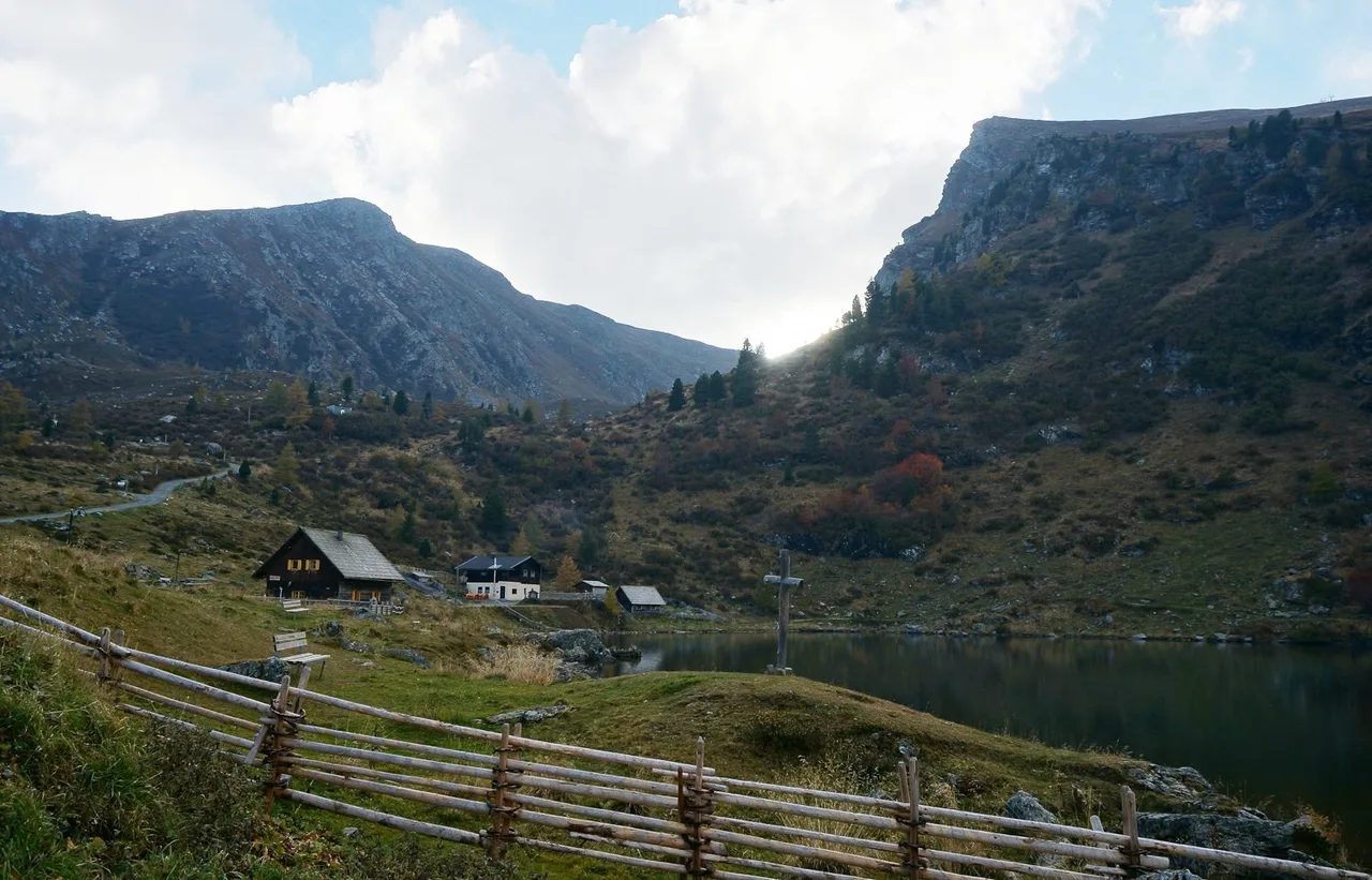
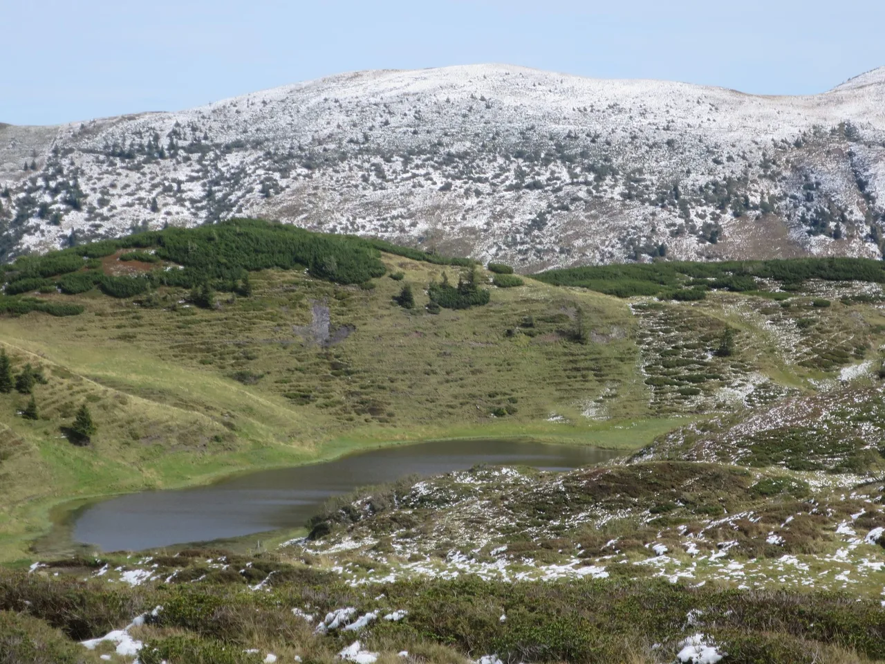
A small lake at roughly 1,700 to 1,800 m, below the Hoher Trieb, with the Zollnersee Hütte beside it. The hut is an Austrian Alpine Club base on the Carnic Peace Trail (KHW 403). Nassfeld tourism says it opens from early June to mid-October and that the road is open to cars from 9 June. A walk from Nassfeld to the hut is a long ridge day. The Geotrail from the hut is a gentle loop with information panels on the rock below your feet, and the best choice here for families and for anyone who wants a lake without a long climb.
Wolayersee
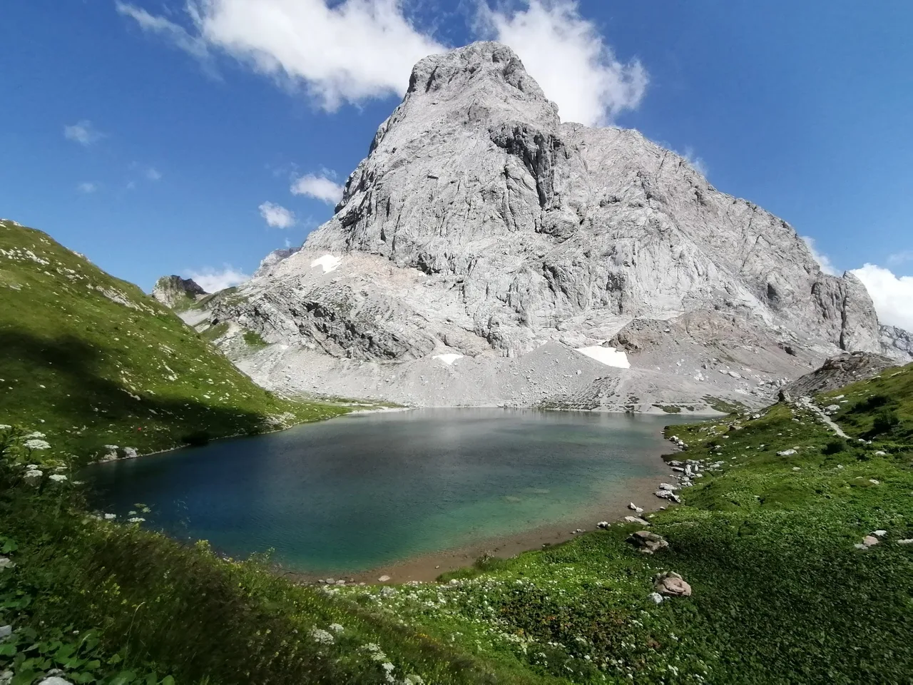
A turquoise high lake on the Carnic main ridge, with a mountain hut at the shore. The Nassfeld tourism site lists it as a medium tour. The official start is in the Lesachtal, and the height difference between the lowest and highest point is 851 m, so this is a proper mountain day rather than a stroll. It is the most scenic of the four, and the one to plan around transport on the Lesachtal side rather than the Nassfeld lifts.
Lago di Pramollo
A small lake right at the Nassfeld pass, on the border between Carinthia and Friuli Venezia Giulia. The name differs by language and by source. The Italian Wikipedia entry for the Passo di Pramollo calls it Lago di Pramollo and describes it as a small alpine lake. The tourism pages of Friuli Venezia Giulia use Lago di Passo Pramollo and Lago Pramollo, and one of them describes it as an artificial lake. The Nassfeld tourism site writes Nassfeldsee. The pass is named for the wet meadows that were here once: Pramollo and Nassfeld both mean roughly "wet field".
The Italian Alpine Club (CAI) path 504 starts at the pass opposite the lake, at 1,528 m, and follows a concreted road to the Casera Auernig at 1,609 m. Nassfeld tourism mentions a promenade path along the west side of the lake, and the tourism pages of Friuli Venezia Giulia give a ring path around the lake of 1.3 km. There is no climb to the lake itself, so treat it as a short walk or a stop before or after a longer hike from the pass.
Walks that start at the lake and pass
- Auernig Höhenweg: rated medium, 5.6 km, 3 hours, 441 m of ascent and descent, from 1,529 m to 1,915 m. From the pass the way passes the church and climbs on a narrow path through alder scrub and dwarf pine to the border ridge, with a short side trip to the Auernig summit at 1,825 m, then continues over the Garnitzenberg and the Gugga to the Garnitzentörl. Nassfeld tourism gives about an hour for the way back.
- Nassfeldpass round hike: rated easy, 9.3 km, 4.3 hours, 465 m of ascent, from 1,529 m to 1,850 m. It follows path 403 from the Gasthof Plattner to the Garnitzentörl (about an hour), then the staffed Garnitzenalm, the Kronalm, the Ofenalm (Malga For) and path 504 to the Auernigalm and back to the pass. Nassfeld tourism calls it a two-country tour and advises taking travel documents.
- Winkelalm: the Nassfeld A to Z page gives about 2.5 km and 40 minutes from the Nassfeldsee towards the old barracks, then about 1 km and 15 minutes from the barracks to the Winkelalm, which lies on the Italian side and serves cake, coffee, ice cream and drinks.
- Casera For: the tourism pages of Friuli Venezia Giulia describe a family-friendly walk from the pass along a forest road to the Casera For at 1,614 m, with CAI markings 504 and 501.
Pressegger See
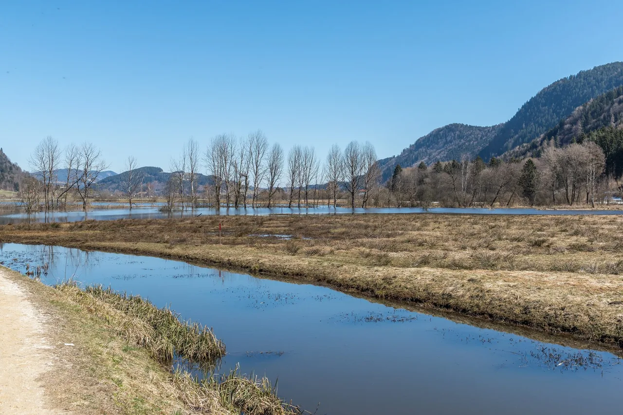
A lowland lake in the valley, with a Slow Trail around it listed by Nassfeld tourism. It has no climb and no snow, which makes it the easiest option here and a good fallback when the weather closes the high ground.
Which one to pick
- Easy lake loop with a hut at the end: the Zollnersee Geotrail.
- A full day with a high turquoise lake: the Wolayersee, if you can organise the Lesachtal start.
- No climbing at all: the Pressegger See or a stroll around the Lago di Pramollo.
- Half a day with some height, starting at the lake and pass: the Auernig Höhenweg (medium) or the Nassfeldpass round hike (easy).
Map
This page has no GPX file and no map line. For navigation use the interactive hiking map on the Nassfeld tourism site, which covers around 1,000 km of marked trails in the region.
Seasonal conditions and safety
High Carnic Alps terrain holds snow in shaded hollows long after the valley is green. Early in the season expect wet ground, slush and possibly steep snow on north-facing slopes. Late in the season, check the opening dates above. In mid-October most lifts and huts are closed or about to close.
In winter the pass is a ski area. The tourism pages of Friuli Venezia Giulia list a lit ring path of 1.3 km around the lake for the ADVENTO Christmas market, open at weekends from 5 December 2026 to 6 January 2027, on 8 December and on Epiphany. Roots and rocks are slippery after rain. Weather in the Carnic Alps changes fast, and the border ridge is not the place to be during a thunderstorm. If you plan to come down by a different path from the way up, decide before the day starts whether you are happy to find your own way, because descents can be harder than the climb.
Practical recommendations
- Footwear: shoes with grip. Trails on the higher tours cross roots and rock.
- Water: the valley has streams, but plan to carry your own supply.
- Cold water: a mountain lake is cold even in summer. A foot soak is easy, swimming needs a towel and a warm layer.
- Food: carry lunch. The Zollnersee Hütte is open from early June to mid-October, so check before you count on a meal there.
- Alternatives: the Zollnersee Geotrail if you want an easy lake loop, the Wolayersee if you can organise the Lesachtal start.
- Lifts: confirm on the day. Operating times are 9:00 to 16:15 in the off-season.
- Border: the Italian border runs over the pass. Nassfeld tourism marks the Nassfeldpass round hike as a two-country tour, so carry ID or a travel document.
Sources and verification date
Checked on 16 October 2026 against the Nassfeld-Pressegger See tourism site (arrival, summer lifts, tour pages, Zollnersee Hütte, Winkelalm), the Austrian Federal Ministry of Agriculture and Forestry education trail page, the regional tourism page for Millstätter See and Bad Kleinkirchheim, the Italian Wikipedia entry for the Nassfeld pass, the tourism pages of Friuli Venezia Giulia and the Julian Alps (Lago di Pramollo, the ADVENTO market, the Casera For walk, the Pramollo ski area) and the Friuli Venezia Giulia section of the Italian Alpine Club (path 504). Lift dates, hut seasons and shuttle rules change every year, so confirm them before you travel.
Related content
- Falkertsee to Sankt Oswald: a Carinthian ridge day in the Nockberge, with a firmer route.
- Pasterze glacier walk: high-mountain walking in the Hohe Tauern.