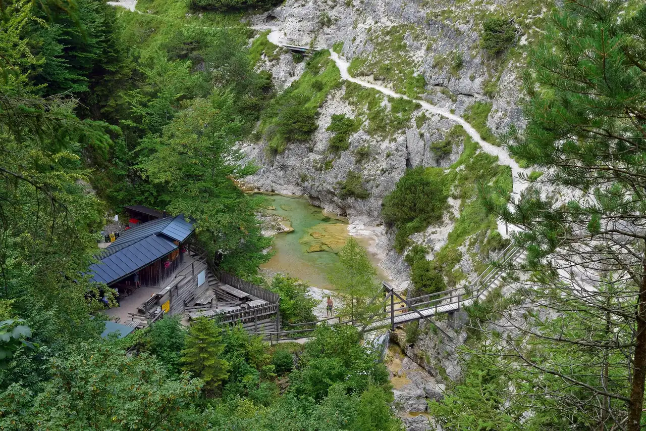
A gorge walk that ends at a lake
This walk drops from a railway village into a limestone ravine, follows a clear river for a while, climbs out of the gorge through forest and finishes beside a long reservoir. It suits walkers who are comfortable on narrow paths and wet rock, who have about four hours to spare, and who like a one-way route where the narrow-gauge Mariazellerbahn handles the transport at one end or both.
A word about the name. The label "Erlaufschlucht" is not quite right. Strictly speaking, the Erlauf has its own gorges in this nature park, the Vordere and Hintere Tormäuer, and they are separate from the path described here. The official tour descriptions call this route Wienerbruck, Lassingfall, Ötschergräben, Erlaufstausee, Mitterbach. The streams you walk beside are the Lassingbach first and then the Ötscherbach. They meet the Erlauf at Stierwaschboden, which is also where you can branch off into the Erlauf's own gorge if you want a longer day. The official names are used below so you can match them to signposts and timetables.
Key parameters
- Length: about 11 km. The official Wienerbruck to Mitterbach suggestion gives 11.2 km, while the GPX of the same route in the opposite direction measures 10.5 km, so expect 10.5 to 11.2 km depending on where you start counting.
- Walking time: about 4 hours without long breaks.
- Height: roughly 250 m of climbing and 260 m of descent in total. The lowest point is around 616 m and the highest around 826 m.
- Difficulty: moderate. The tourism board rates the fitness demand at 3 out of 6.
- Route type: point to point, Wienerbruck to Mitterbach.
The height figures come from the official profile of the opposite direction (Mitterbach to Wienerbruck: 258 m up, 250 m down). We reversed them for the direction described here, so treat them as good estimates, not survey values.
Start and finish
The start is the Naturparkzentrum Ötscher-Basis in Wienerbruck (address Langseitenrotte 140, 3223 Wienerbruck), a few minutes on foot from the Mariazellerbahn stop Wienerbruck-Josefsberg. The village sits at about 790 m. The station is mapped in OpenStreetMap at roughly 47.8565 N, 15.3072 E.
The finish is in Mitterbach am Erlaufsee, at the Mitterbach station of the Mariazellerbahn or at the Stapelhaus on the Erlaufstausee, which the nature park lists as an entrance and refreshment stop. No coordinates are given for the finish.
How to get there
The Mariazellerbahn is the natural way to do this walk. It is a 760 mm narrow-gauge railway between St. Pölten and Mariazell, and both Wienerbruck-Josefsberg and Mitterbach are stops on it. A common plan is to leave the car at the Ötscher-Basis in Wienerbruck, walk to Mitterbach and ride the train back to the start. Without a car, take any regional connection to St. Pölten Hbf and change to the narrow-gauge line there.
For a sense of the journey time, the park's own school-programme page lists a train leaving St. Pölten at 8:37 and arriving in Wienerbruck at 10:32, so plan on roughly two hours from St. Pölten. That is an example, not a timetable. Check the current times at mariazellerbahn.at or in the ÖBB planner before you go.
Two dates matter right now. The railway announces replacement buses instead of trains between St. Pölten Hbf and Mariazell from 2 to 20 November 2026, and the nature park starts its winter closure of the gorges on 2 November (details in the safety section). We checked both on 16 October 2026.
By car, the park describes the drive from Vienna as about 1.5 hours via the A1 and St. Pölten. Parking at the nature park is paid. The park lists 6 EUR for a car for the day, and the tour page for the Ötscher-Basis car park warns that its machine may accept coins only, so carry some.
Route description
From the Ötscher-Basis to the Lassingfall
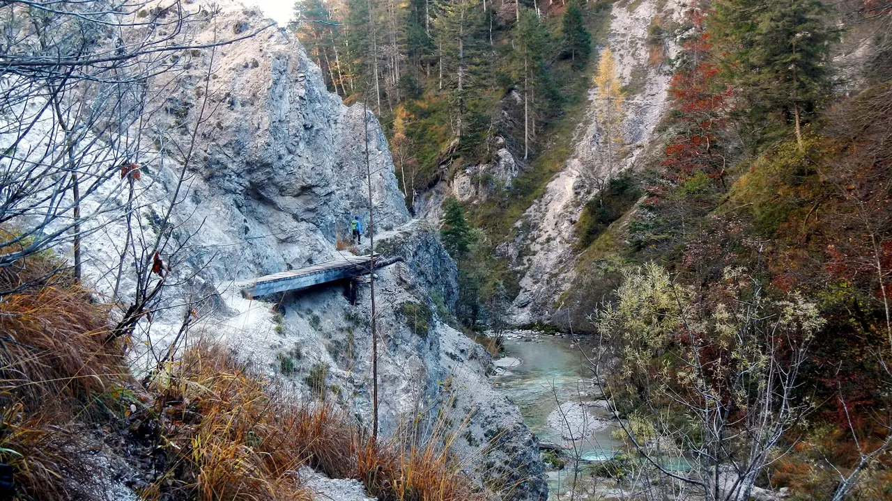
The path starts at the Ötscher-Basis and runs along the Wienerbruck reservoir to the foot of the dam. Below the dam wall it enters the narrow gorge of the Lassingbach. The way is a narrow but well-built Steig, with rock steps, bridges and short passages through the rock. Mostviertel Tourismus gives about 45 minutes from Wienerbruck to the Lassingfall, with a viewpoint beside the path that gives the best look at the fall.
The Lassingfall drops about 90 m, which is the figure the official tourism pages use. If you have read about a 90 m waterfall in this area, this is very likely the one. The falls deeper in the Ötschergräben are not on this walk, and the separate guide explains why we print no height for them.
Do not expect a thundering cascade in every season. The river was dammed for a hydropower plant in 1908, and its water is led through a pressure tunnel with a drop of roughly 170 m. As a result, the flow at the fall is rather modest. The tourism board says the fall and the stream look best in spring and after heavy rain.
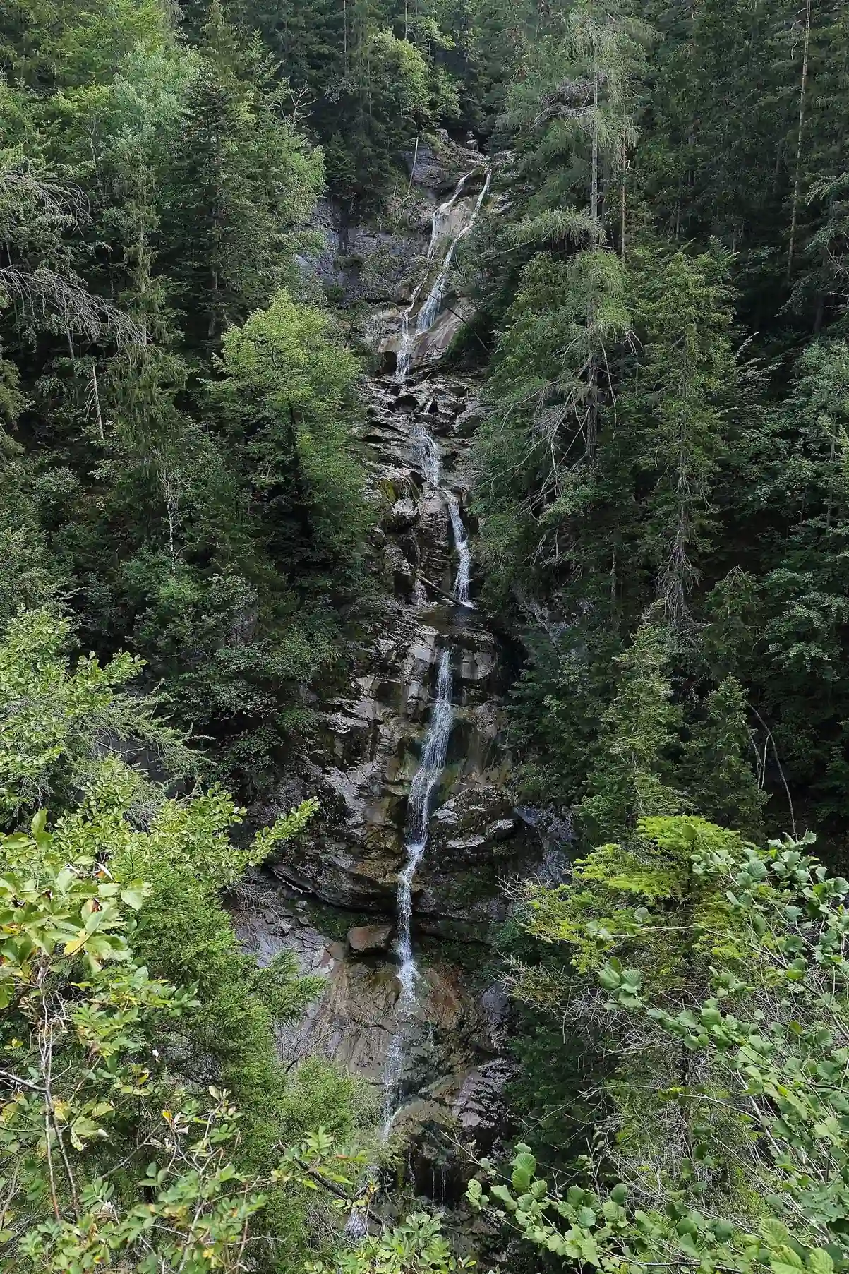
One safety note from the same official page: do not scramble in from the side of the Kienbachfall. The page warns of extreme danger of falling there. Stay on the marked path to the viewpoint.
Down to the power plant at Stierwaschboden
Beyond the fall the path keeps descending to Stierwaschboden, where the Kraftwerk Wienerbruck stands among the trees. From the Ötscher-Basis to here is only 2.26 km, with about 172 m of descent, and a children's theme trail called "Entdeckungsreise Kraftwerk" follows the same line. The plant started operating in 1910 to feed the Mariazellerbahn, and in the hiking season visitors can enter a gallery in the machine hall. The mountain stream you have followed is the Lassingbach, and it joins the Erlauf near here.
This is also the branching point for a longer variation. A path leads through the Hintere Tormäuer, the Erlauf's own gorge, to Erlaufboden. There is no public transport at Erlaufboden, and the climb from there to Gösing station takes roughly an hour according to Mostviertel Tourismus, so we would only recommend it with spare time and daylight.
Along the Ötscherbach to the Ötscherhias
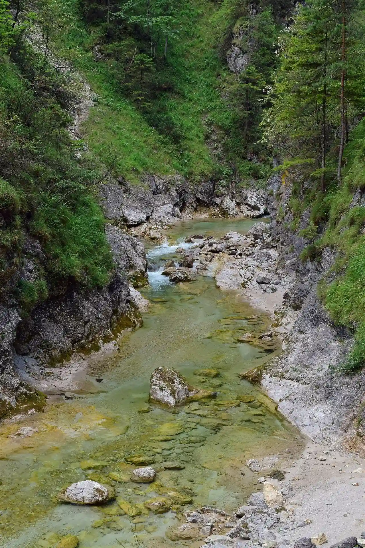
From Stierwaschboden the Ötscherbach takes over. This lower part is called the Vordere Ötschergraben and runs from the power plant to the Jausenstation Ötscherhias, a mountain refreshment hut. The paths here follow old routes laid out by woodcutters and have been improved with steps and bridges. The water is clear and green over pale limestone, with pools and small cascades beside the path. Use the pools for photographs, not for a swim or a paddle on slippery rock.
The climb to the reservoir
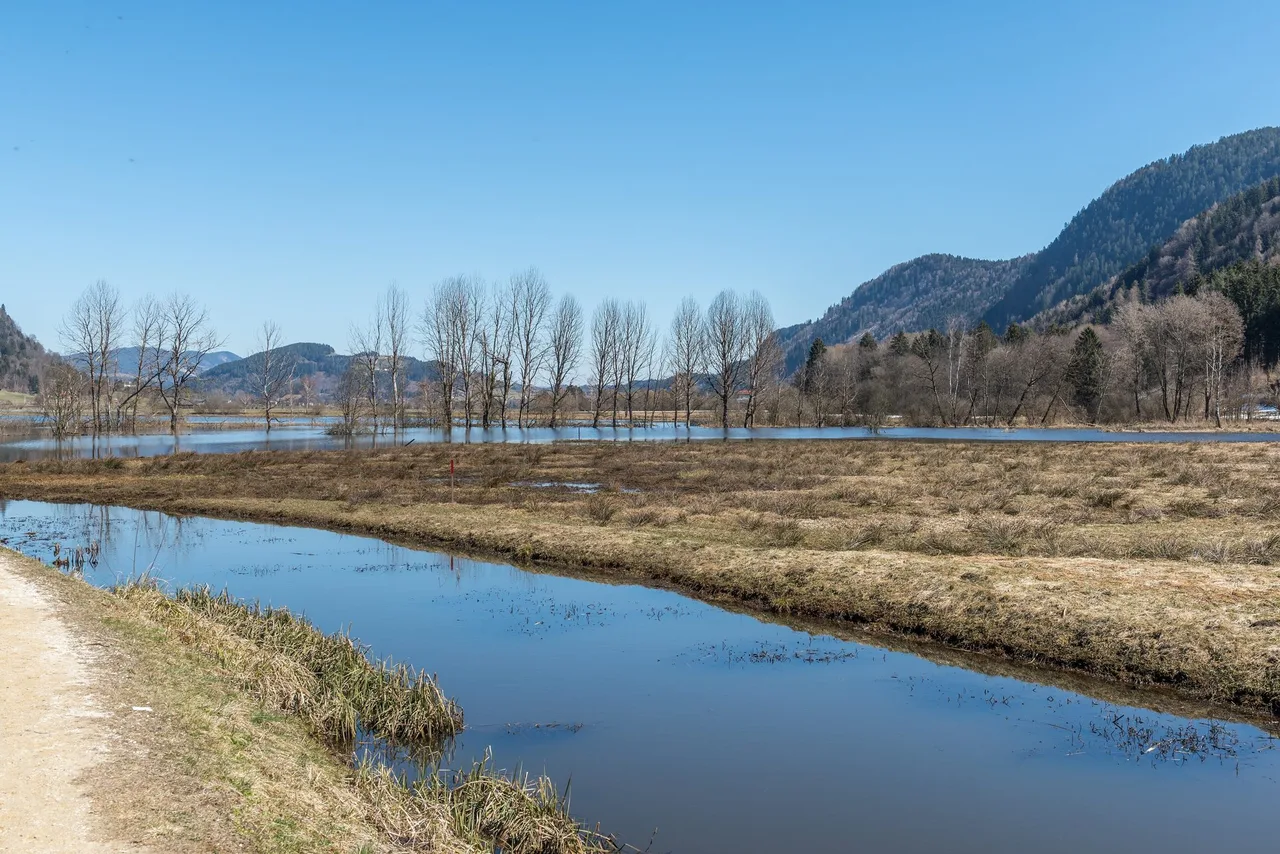
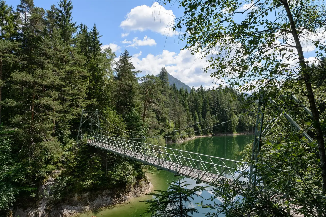
At the Ötscherhias the walk changes character. A short climb leads up through forest, past an old mill wheel, to the Ötscherstraße near the Hagengut. The highest point of the official profile is about 826 m. From the Ötscherstraße you walk along the Ötscherstraße and the shore of the Erlaufstausee, which the tourism board describes as fjord-like, all the way to Mitterbach.
Tired legs have a way out. The Erlaufklause stop on the Mariazellerbahn lies at the Erlaufstausee, on the way to Mitterbach, so a shorter version of the walk, about 8 km and roughly 3 hours according to the official tips, ends there instead of in Mitterbach. The full walk continues to Mitterbach and the Stapelhaus.
Map
There is no track, GPX file or route map on this page. Official GPX downloads exist for the opposite direction on the Mostviertel Tourismus tour page "Mitterbach, Erlaufstausee, Ötscherhias, Stierwaschboden, Lassingfall, Wienerbruck". Download that file from the source if you want a track, and check the current path closures first.
Seasonal conditions and safety
- Winter closure: as of 16 October 2026 the nature park says the Ötschergräben and the Hintere Tormäuer can be walked until the end of October, and that the annual winter closure begins on 2 November. The park does not say in that notice whether the Lassing gorge section is included, so check its news page before a late-autumn trip.
- Rail: replacement buses run between St. Pölten Hbf and Mariazell from 2 to 20 November 2026, so the train-back plan does not work in that period.
- Water and weather: after rain the paths are wet and the rock is slippery, and the waterfalls carry more water. In dry weeks the Lassingfall can look thin.
- Exposure: the path is narrow in places, with steps, bridges and rock passages. Keep children close and stay behind barriers.
- Closures: the park publishes path and road closures on its "Aktuelles" page. Mostviertel Tourismus asks walkers to read it before every visit.
Practical recommendations
- Water: no verified drinking-water points are listed on the route, so carry what you need. The Ötscherhias hut is a food stop, so check its opening times.
- Food: the Regionalküche at the Ötscher-Basis is listed as open Friday to Sunday and on public holidays from 11:00 to 19:00 in September and October 2026 (kitchen 12:00 to 18:00), until 31 October. In Mitterbach, the Stapelhaus at the Erlaufstausee serves as the refreshment stop named by the park.
- Footwear: sturdy shoes with good grip and rain protection, as the official tour page advises.
- Entry fee: the nature park charges entry, 5 EUR for adults and 2 EUR for children aged 6 to 14, and you can pay in the Mariazellerbahn. The Wilde Wunder Card gives free entry once.
- Dogs: welcome on a lead. The train carries dogs for a fee, and muzzle and lead rules apply there.
- Accessibility: with narrow steps and rock passages, the route is not suitable for prams or wheelchairs, judging by the official description of narrow paths and Steige.
- Shorter options: the Ötscher-Basis to Kaiserthron loop is about 3 km and 1 hour. The official family walk via the Lassingfall and the power plant to the Kaiserthron viewpoint and back to Wienerbruck is another short choice. The Wienerbruck to Erlaufklause walk is about 8 km.
- Longer options: see the Ötschergräben guide for the deeper gorge beyond the Ötscherhias.
Sources and verification date
Facts were checked on 16 October 2026 against the official pages of the Naturpark Ötscher-Tormäuer (access, fees, closures), Mostviertel Tourismus (tour data, Lassingfall), the Mariazellerbahn site (replacement buses), the German-language Wikipedia articles on the Lassingbach, the Kraftwerk Wienerbruck, the Ötscherbach and the nature park, and OpenStreetMap (station position). Distances and times differ slightly between official pages, as noted above. Photographs are credited with the images.
Related content
- The Ötschergräben: Austria's Grand Canyon in Lower Austria: the deeper gorge, its waterfalls and the story of the power plant.
- Thayatal National Park: Austria's Smallest Wild Valley: another protected river valley in Lower Austria.