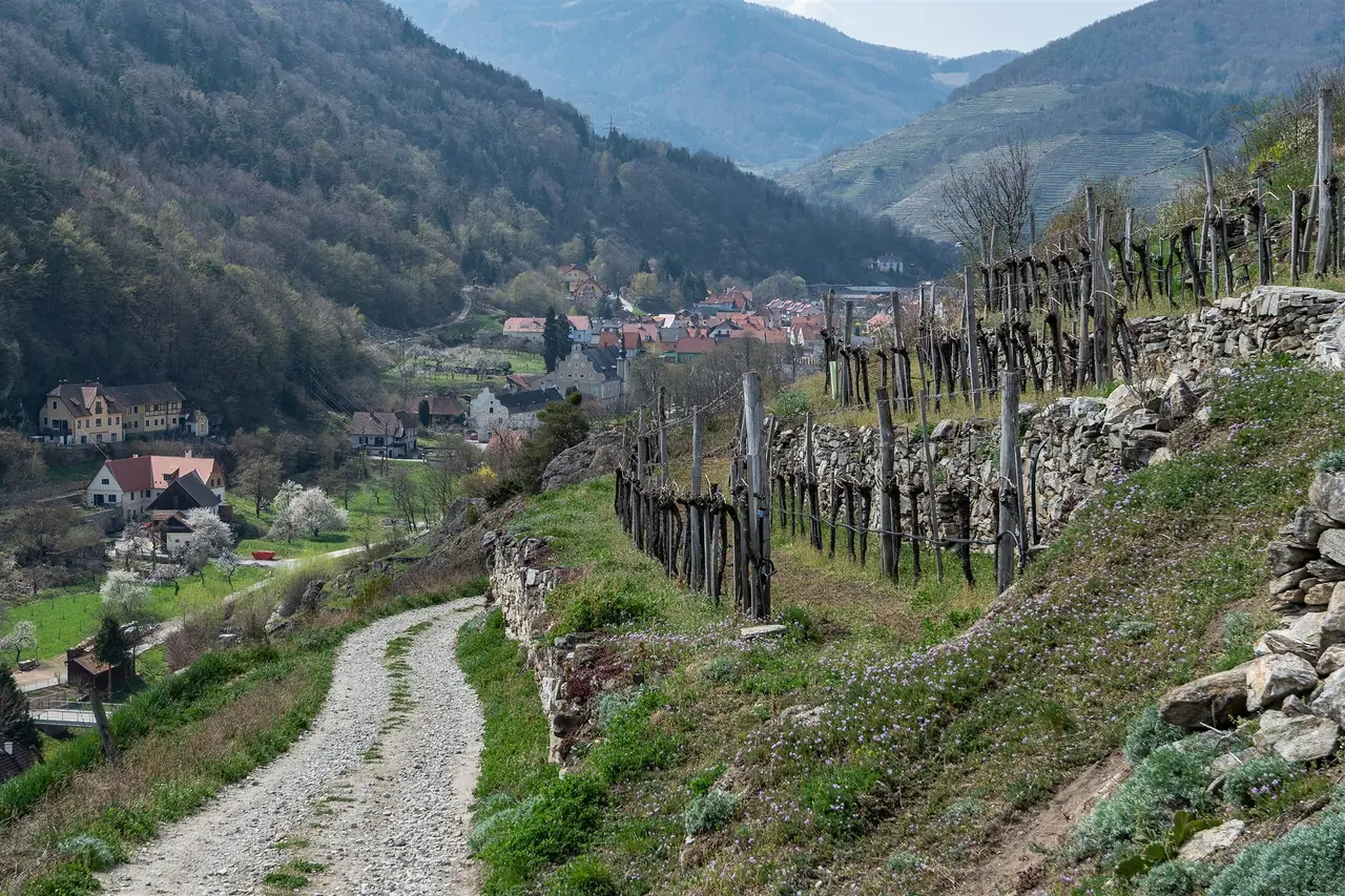
We planned 17 kilometres and walked about ten
Six of us, children included, set out from Spitz on a Saturday with roughly 17 km in mind, heading toward Mühldorf. The day was sunny, with no clouds and no wind. We went a little past the middle of what we had planned, then turned back toward Spitz, and the day added up to about 10 km. This article follows that day and adds checked background, so you can plan your own version with better odds against the heat.
Two marked trails serve this direction. The Welterbesteig Wachau, stage 4, is listed by the regional tourism board as running from Spitz to Mühldorf through the Spitzer Graben, the side valley that leads from the Wachau into the Waldviertel. The Panoramaweg Spitzer Graben, a themed trail created by the Marivino winegrowers' association, uses the same valley. Both are described below, with the points where they differ.
Why Spitz is a good place to start
Spitz wraps around the Tausendeimerberg, whose name, "thousand buckets hill", refers to the local story of how much wine the slope can yield. The village has Renaissance and Baroque houses, a late Gothic church and a shipping museum in the Erlahof, and the railway, the bus and the ferry all stop within walking distance of each other. That matters for a trail like this one, because the day only works if the way home is simple.
The Marivino association was founded in 2004 by businesses from Spitz and Mühldorf. Its Panoramaweg is subtitled "from wine to apricot" and has four themed huts along the way, where members serve their own wine, juice and snacks when the weather is good. Think of the huts as bonuses, not as a plan for lunch.
Key parameters
What we walked, and what the listings say:
- Our day: about 10 km on foot, in strong heat, with a turn-back we chose ourselves. Planned distance: about 17 km.
- Welterbesteig stage 4, Spitz to Mühldorf: about 10.8 km one way, about 4 h 30 min, about 480 m of ascent, between roughly 251 and 443 m above sea level. The listing is supplied by the Lower Austria Danube tourism board and rates it easy for fitness, with a medium technical score.
- Panoramaweg Spitzer Graben loop: about 18.6 km, about 6 h 20 min, about 630 m of ascent, between roughly 200 and 441 m. The listing rates it medium. This is the closest match to the planned 17 km.
- Official walking times on the Panoramaweg, one direction from the entry at the car park near the B217: 30 minutes to the Setzberghütte, 45 to the Zornberghütte, 25 to the Bruckhütte, 30 to the Marillenhütte, 40 to Burg Oberranna. That adds up to 2 h 50 min of walking time without breaks.
For the facts panel of this article we used the stage 4 figures, because Spitz to Mühldorf is what the title promises. Treat our own 10 km as a day out, not as a route length.
Start and finish
Stage 4 starts at the Kirchenplatz in Spitz an der Donau, the church square. The Spitz railway station is on Bahnhofstraße, at about 48.36503 N, 15.41746 E according to OpenStreetMap. The coordinates in the facts panel are the station, because it is the most practical arrival point.
The stage ends in Mühldorf, in the Waldviertel at about 360 m above sea level. Burg Oberranna, the castle at the head of the valley, lies in the municipality of Mühldorf at about 48.38005 N, 15.33935 E.
How to get there
Spitz is a stop on the Wachaubahn between Krems and Emmersdorf, which runs on Fridays, Saturdays, Sundays and holidays from 13 March to 15 November 2026 and daily between 24 April and 1 November. Bicycles go free. Buses 715 and 720 also serve the valley, and a cable ferry crosses from Arnsdorf on the south bank in five to seven minutes. It runs from 06:15 to 19:00 on weekdays from March to October and from 08:15 to 19:30 on weekends. Bring cash.
Mühldorf lies off the Danube, so the trip back is the open question. The sources checked list no public transport connection from Mühldorf to the Danube. Plan a return on foot, an out-and-back, or check the VOR regional bus timetable for a connection before you commit to the full one-way distance.
Route description
The stage description from the tourism board begins at the Kirchenplatz and follows Friedhofgasse west. At the nature park shop, a narrow path turns off to the left and climbs onto the Tausendeimerberg, the steep vineyard that gives Spitz its landmark view over the village and the river. A farm track then runs down through the vines into the Quitten district.
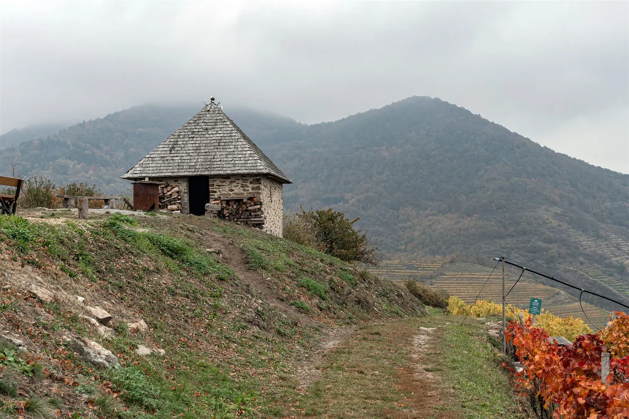
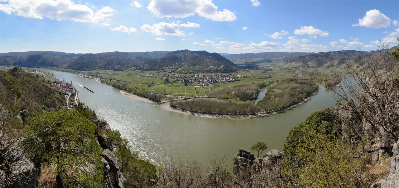
From there the route enters the Spitzer Graben, a side valley that, according to the tourism board, once carried the Danube itself. That is why it is the largest side valley of the Wachau. The steepest terraces in the Wachau are in Gut am Steg, Vießling and Elsarn, which are all in the same side valley. Along the way the Panoramaweg passes the Setzberg vineyard and a chain of small huts. The Zornberghütte, at about 420 m, is run by Marivino winegrowers in fine weather on many Sundays and holidays from around May. The Bruckhütte and the Marillenhütte follow, then the path reaches Burg Oberranna and Mühldorf.
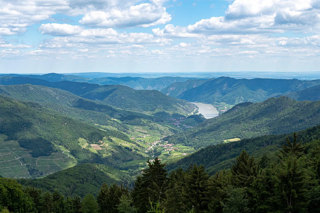
The surface changes often. The listing mentions asphalt, gravel, meadow and forest. Our group saw vineyard terraces, green hills, old estates, long views and stretches of shade under trees. The shade mattered. On a day without clouds or wind, the exposed terraces are where the heat hits hardest, and the forest sections are where you recover.
The demanding parts are the steep terrace sections and the long exposed stretches rather than any technical ground. If you go in summer, plan the climb for the cooler hours.
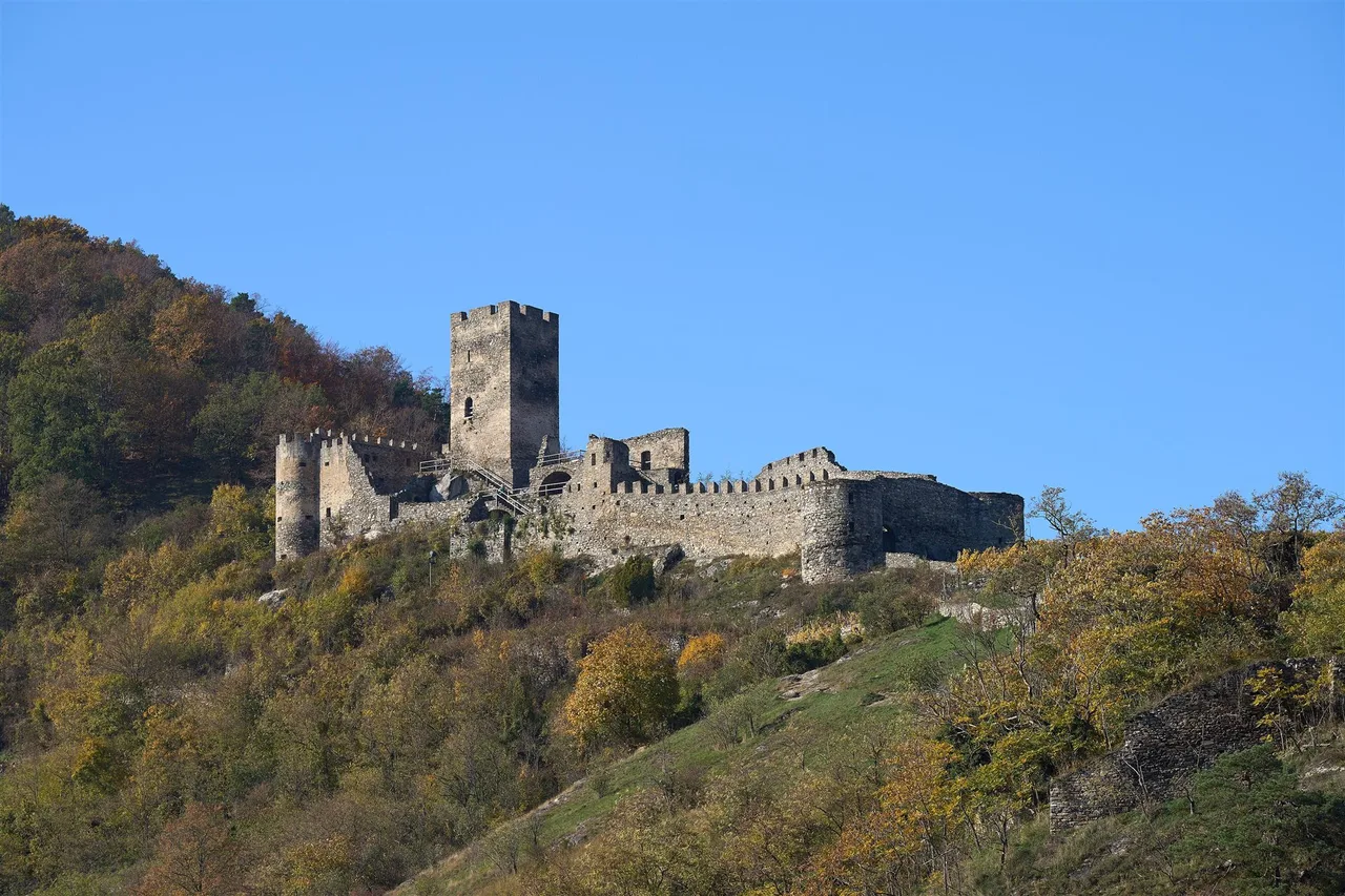
The Hinterhaus ruin above Spitz guards the entrance of the valley. Burg Oberranna is the counterpart at the other end. At the top of the valley, Mühldorf sits among meadows and fruit trees. The tourism board mentions apricot blossom in spring and awarded Grüner Veltliner, Riesling and Neuburger wines, and notes that graphite was once mined at the edge of the village.
A sensible plan for a hot day
The official walking times for the Panoramaweg let you build a schedule with natural turning points. Counting from the entry near the B217 car park, the cumulative walking time is about 30 minutes to the Setzberghütte, 1 h 15 min to the Zornberghütte, 1 h 40 min to the Bruckhütte, 2 h 10 min to the Marillenhütte and 2 h 50 min to Burg Oberranna. These are walking times without rests, one way.
On a sunny day with no wind, that suggests a clear rule: start early, pick the hut you want to reach, and add the same time again for the return, plus a margin for the heat. Our own group turned back when the heat made the rest of the plan unrealistic. If you have children with you, decide the turning point at the start rather than at the moment when everyone is tired.
Map and track
There is no GPX track on this page. Official track data belongs to the stage 4 listing and the Marivino Panoramaweg. Follow the waymarks, and use the official stage description for navigation.
Seasons and safety
Heat. The terraces store the day's warmth, and a sunny, windless summer day makes a 17 km plan risky. That is why we turned back.
Spring. Apricot trees flower in the Wachau from around mid-March to mid-April, and the Mühldorf end of the valley is known for its blossom.
Summer. The Marillenkirtag in Spitz is held around the second-to-last weekend of July. In 2026 it ran from 17 to 19 July. On our Saturday, Spitz was hosting its apricot festival, the Marillenfest as we called it, with live music and performances. Expect crowds near the church square and plan parking and trains accordingly.
Autumn. The Spitzer Weinherbst runs from 4 September to 26 October in 2026. Huts may close earlier than you expect, because they open only in fine weather.
Safety. Check the forecast. Storms on open terraces are no place to be.
Practical recommendations
- Water. Water points are not listed in the sources. Carry at least a litre and a half per adult in summer, and more for children.
- Sun. Hat, sunscreen and light long sleeves. Start early.
- Footwear. Shoes with a firm sole. The paths are a mix of asphalt, gravel and meadow.
- Food. The huts are open only in fine weather and on selected days, so do not count on them. Eat in Spitz before and after.
- Dogs and children. Our group included children and managed the distance we chose. Keep dogs on a lead near vineyards and pastures.
- Vineyards. Stay on the path and leave the grapes and apricots alone.
- Shorter versions. The Setzberghütte is 30 minutes from the car park entry and the Zornberghütte another 45. Either makes a sensible turning point on a hot day.
- Longer versions. The full Panoramaweg loop is about 18.6 km. Or continue from Mühldorf toward Maria Laach on stage 5.
What we found on the way back
Back toward Spitz we passed a small courtyard with a fig tree. The owners, smiling, let us taste figs from the tree, and we bought some fresh fruit from them. It was a private courtyard, so we are not naming it. Treat it as luck rather than a stop on the route.
The festival offered apricot dishes: dumplings, sauces, meat in an apricot sauce and lemonades. The Marillenkirtag is a good excuse to arrive by train and leave the car at home.
Sources and verification
Checked on 16 October 2026 against the Lower Austria tourism pages for the Spitzer Graben, the Marivino association, the Donau Niederösterreich pages on the Welterbesteig, the Wachaubahn and the Spitz municipality, Austrian tourism event listings and OpenStreetMap. Distances and times for the two trails come from tourism listings.