Who this walk is for
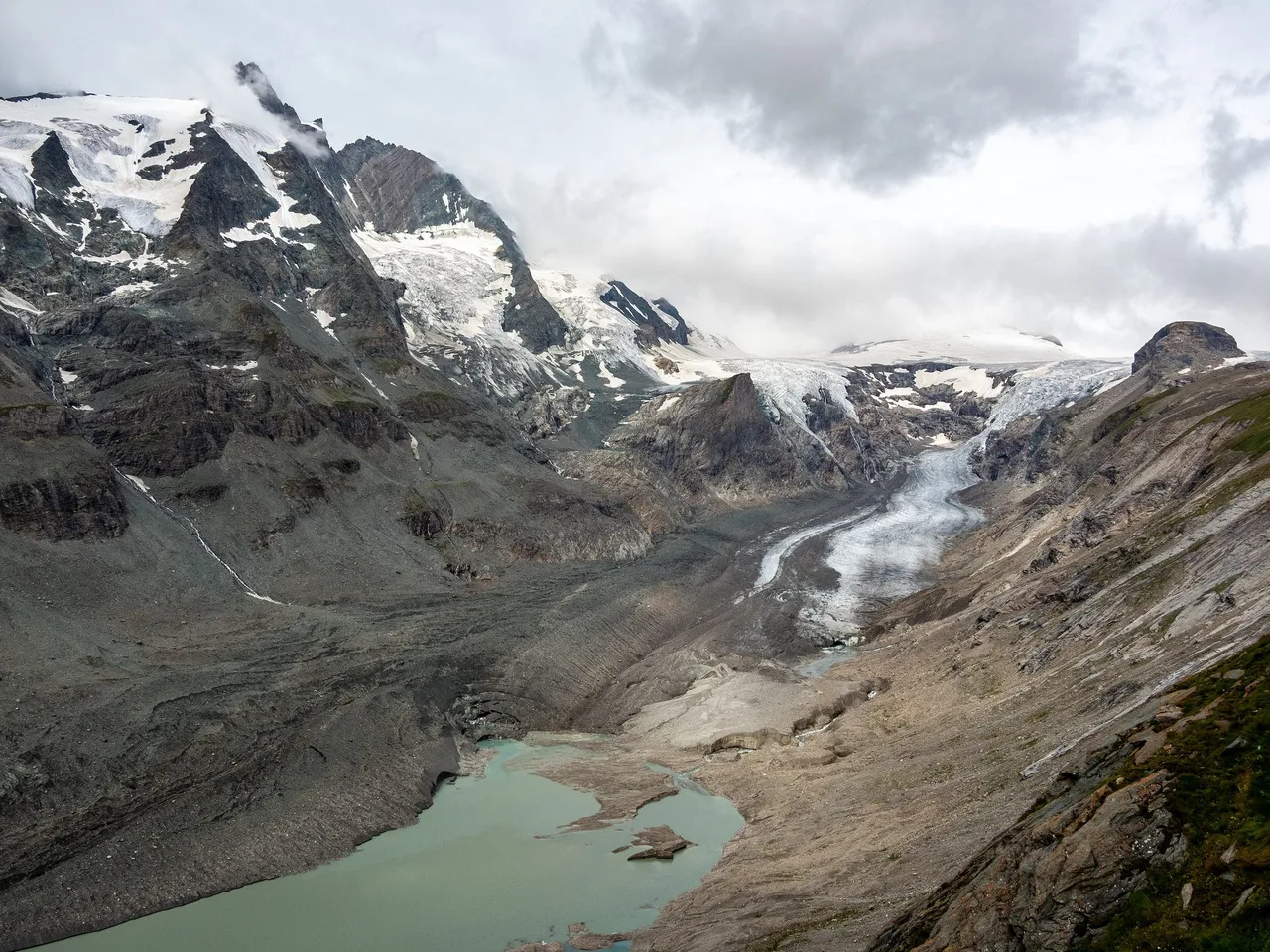
A funicular opened in September 1963 to carry visitors from Kaiser-Franz-Josefs-Höhe down to the edge of the Pasterze. It has been closed since 2025, after 61 years of service. Today the glacier lies a long way below where the lower station once stood, and the walk to it makes the change easy to see.
This is a route for walkers who are comfortable on a mountain path for most of a day and want to see why the Pasterze is in the news. The paths are technically simple, which makes it workable for a group with mixed fitness. Our own trip was a group outing and fairly easy. The effort came at the end, with the climb back up to the road.
The Pasterze is the largest glacier in the Eastern Alps, at the foot of the Grossglockner (3,798 m), Austria's highest mountain. It lies in the Hohe Tauern National Park. The walk combines an alpine valley path, a reservoir with two dams, a wooden suspension bridge over the Möll, a view of the glacier tongue and, on the Gamsgrubenweg, a series of tunnels with views of the mountain.
Key parameters
The numbers below come from the Hohe Tauern National Park, which describes a reference route from the Glocknerhaus to Kaiser-Franz-Josefs-Höhe: about 8 km and 600 m of ascent. The park lists the walk as a medium-difficulty hike in high alpine terrain. The Heiligenblut tourist office describes the Gletscherweg from the Glocknerhaus as about four hours with about 400 m of height difference, technically easy but requiring sure feet, suitable for children from around ten, best from July to October. The park's own school-programme sheet quotes about six hours. The gap is stops and pace, so no single duration is given; plan a full day.
The final climb from the Margaritze reservoir (about 2,000 m) to Kaiser-Franz-Josefs-Höhe (2,369 m) is roughly 370 m. Figures for the retreat of the glacier are in the section on seasonal conditions below.
Start and finish
Start: the Glocknerhaus, an Alpine Club hut at 2,132 m beside the Grossglockner High Alpine Road. The coordinates in the article data (47.0697, 12.7683) come from OpenStreetMap. Finish: Kaiser-Franz-Josefs-Höhe, at 2,369 m, the end of the Pasterze branch of the High Alpine Road, with a visitor centre, restaurants and a bus stop nearby. OpenStreetMap shows a bus stop called Franz-Josefs-Haus on the road a few hundred metres from the visitor centre.
Our group walked both parts of the area, the valley path to the glacier and the Gamsgrubenweg, and finished with the climb to a bus stop. This description follows the National Park's reference route and marks where our day matches it.
How to get there
The only road to the area is the Grossglockner High Alpine Road, a toll road. The official site gives 2026 opening hours of 6:00 to 19:30 until 26 October, then 8:00 to 17:00 from 27 October, with the final winter closure expected in early November. The visitor centre at Kaiser-Franz-Josefs-Höhe is open daily from 10:00 to 17:00. Road conditions can close the road at short notice, so check before you drive.
Public transport is seasonal. A Postbus line runs between Heiligenblut and Kaiser-Franz-Josefs-Höhe, three times a day from 31 May to 13 September 2026 according to Carinthian tourism, so it was not running on 16 October. From the Salzburg side the Glocknerbus runs with National Park rangers on board, with departure times on the official page. The approach we remember ran up the valley past mountain villages, hotels, rivers and waterfalls and along part of the High Alpine Road. The ÖBB timetable at fahrplan.oebb.at covers the rail leg to the region.
The road itself has a history worth a short mention. According to the official site, the first blasting took place on 30 August 1930, and President Wilhelm Miklas opened the road on 3 August 1935. It is 48 km long with 36 bends. Up to 4,000 men worked on it. The official history stresses the number of workers and the hard conditions. The first car crossing took place on 22 September 1934, in a converted Steyr 100.
Route description
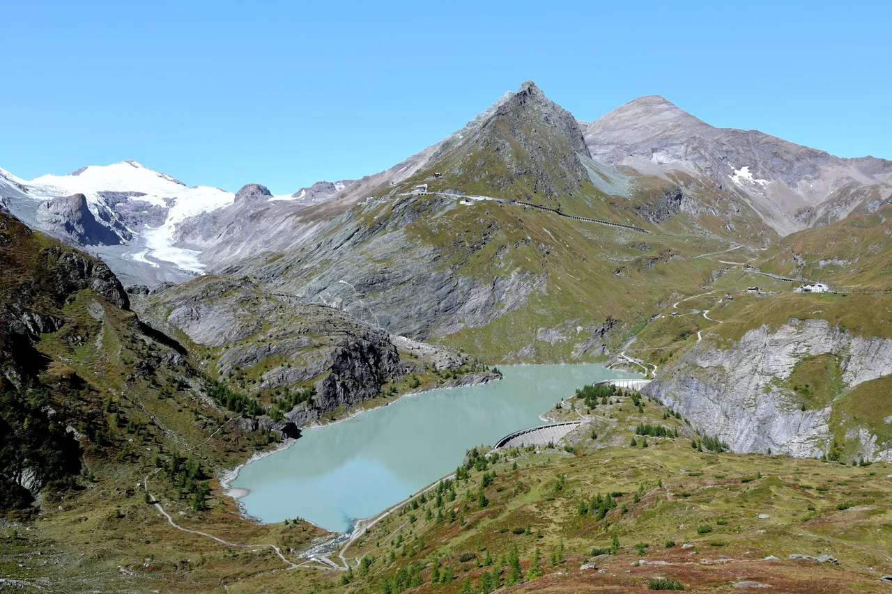
The reference route starts at the Glocknerhaus and leads down over alpine meadows toward the valley floor. Then it crosses the Margaritze reservoir on top of its two dams. The two dams, the Möllsperre and the 39 m high Margaritzensperre, form the reservoir. Wikipedia says it was completed in 1953 as part of the Kaprun power plants and lies about 2 km below the end of the glacier.
Above the dams the way runs up the valley along the Möll, which rises from the Pasterze. OpenStreetMap records a wooden simple suspension footbridge in this valley, which matches the suspension bridge we crossed. The way continues over the glacier foreland, past moraines and polished rock, toward the old lower station of the funicular, where you could once step onto the ice. On the National Park's Gletscherweg special attention goes to moraines, glacial polish and a glacial pothole, and to the pioneer plants of the foreland.
From the lower station the Gletscherweg climbs to Kaiser-Franz-Josefs-Höhe. The Heiligenblut tourist office counts 522 steps from the road down to the old station. Since the funicular closed, the same office says a walk of about two hours is needed to reach the glacier. The High Alpine Road site still quotes about 30 minutes down and about an hour back up, which looks like a figure from the funicular era and no longer matches the retreated ice. Plan on the longer time, and wear sturdy footwear.
The Gamsgrubenweg
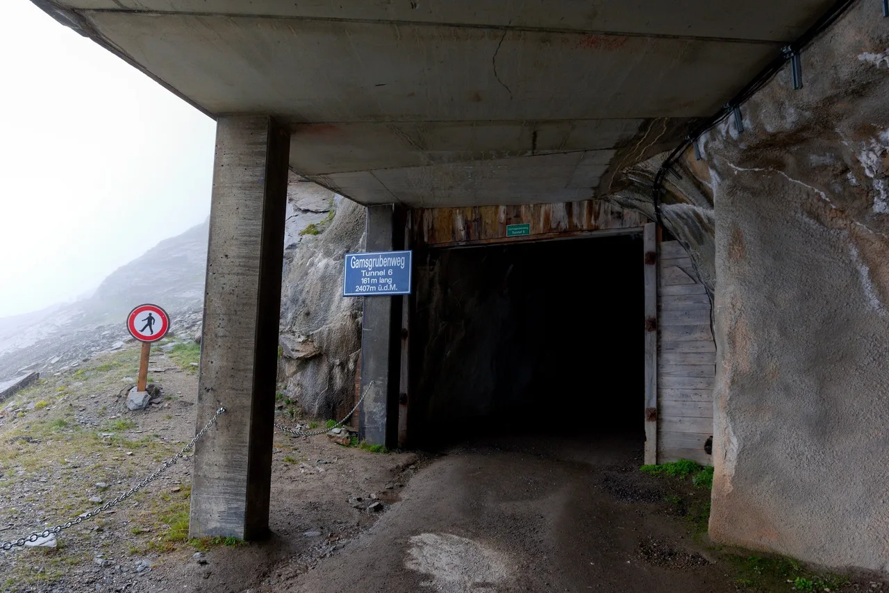
The second part of the day, as we remember it, was the Gamsgrubenweg, a high path with a series of tunnels and views across the Pasterze to the Grossglockner. The National Park describes it as a trail of about 2.5 km and about one hour, a red mountain trail, open June to September. The first panels tell the story of the glacier and the mountain names. The second part of the tunnel system has an exhibition about gold, water and rock crystal, with a "water organ". That matches our memory of a tunnel with a small exhibition about glacier history, crystals and mountain treasures.
An important change: according to the official High Alpine Road site, the Gamsgrubenweg is currently passable only up to the exit of tunnel 6, and the path beyond is blocked. The last tunnel is only for experienced alpinists with helmets and equipment, at their own risk. The circular route via the Hofmannsweg is also affected. Tunnel 6 itself is 161 m long and lies at 2,407 m, according to the sign at its portal.
Map
No track is provided on this page. OpenStreetMap carries the Gletscherweg Pasterze as a hiking route maintained with data from the National Park administration, and the Gamsgrubenweg and its tunnels are mapped in detail. Use the National Park's trail pages or the official hiking maps of the Grossglockner High Alpine Road for navigation.
Seasonal conditions and safety
The Gamsgrubenweg is open June to September, and the High Alpine Road closes for winter in early November. On our verification date the road was open with short opening hours, the Postbus line had finished for the season, and the tunnel path beyond tunnel 6 was closed.
The glacier is changing fast. The Austrian Alpine Club measures the glacier tongue every year. Wikipedia quotes its reports with 54.4 m of retreat in 2014/15 and 52.5 m in 2020, and the club's press summary for 2022/23 named a record 203.5 m. Wikipedia gives a length of about 8.3 km in 2006 and says the area has shrunk by almost half since 1856, from more than 30 km². NASA's Earth Observatory reported on 31 August 2026 that the last icefall connecting the upper and lower parts of the glacier, the Hufeisenbruch, had narrowed from nearly 900 m wide in 1998 to 120 m in 2025. NASA says the last icefall may survive another year or two, or may break before the cold months of 2026. When it breaks, the Gepatschferner in Tyrol will become Austria's largest glacier.
For walkers, the practical consequences are rockfall and unstable ground. Stay on the marked path in the foreland. Do not walk onto the debris-covered ice, and keep away from the edge of the proglacial lake, where ice can break off. A walk to the glacier is not a glacier tour.
Practical recommendations
- Footwear: sturdy boots. The official pages ask for them.
- Weather: weatherproof clothing, even in summer. The park's school programme on the Gletscherweg starts from the end of May.
- Water and food: carry both. The Glocknerhaus and the restaurants at Kaiser-Franz-Josefs-Höhe are the supply points.
- Accessibility: the visitor centre is mapped as wheelchair accessible in OpenStreetMap, but the glacier path is a mountain trail and is not suitable for wheelchairs or pushchairs.
- Shorter option: walk down from Kaiser-Franz-Josefs-Höhe to the glacier and back. The park calls this the simpler variant, but with the funicular closed it is no longer short: the Heiligenblut tourist office says to allow about two hours to reach the glacier.
- Guided option: the park offers ranger-led programmes, including a free panorama tour from the visitor centre. Check the dates.
- Fees: the High Alpine Road charges a toll. See the official page for the current rates.
Sources and verification date
Checked on 16 October 2026 against the Grossglockner High Alpine Road site (opening times, history, Kaiser-Franz-Josefs-Höhe, Gamsgrubenweg status), the Hohe Tauern National Park, the Heiligenblut tourist office, Carinthian tourism for the bus, Wikipedia for the reservoir and glacier data, OpenStreetMap for coordinates and the suspension bridge, the Austrian Alpine Club figures as summarised in public reports, and the NASA Earth Observatory story of 31 August 2026.
Related content
- Falkertsee to Sankt Oswald: a gentler Carinthian mountain day in the Nockberge.
- Lake hikes around Nassfeld: an overview of the lake tours near the Italian border.